Full article about Santa Clara-a-Velha
Santa Clara-a-Velha, Odemira: a 13th-century church, 633 souls and 163 km² of cork-oak quiet in the Alentejo
Hide article Read full article
The church that names the silence
Slanted morning light slips through the single lancet of Santa Clara of Assisi, printing pale gold rectangles onto limewashed stone. Outside, the hush is almost viscous – broken only by a dog barking somewhere beyond the cork ridge and the iron yawn of a farm gate. This is the administrative heart of a parish that sprawls across 163 km² of montado – the open oak savannah that dominates south-western Alentejo – yet houses just 633 people. Population density: 3.9 souls per square kilometre, less than the Siberian taiga.
A thirteenth-century gravity well
The church has stood since the late 1200s, a modest Romanesque rectangle with a bell that replaced an earlier hermitage dedicated to the Poor Clare who gave the place its name. The suffix “a-Velha” – “the Old” – was formalised in 1926 to distinguish it from the drowned village of Santa Clara-a-Nova, relocated when the dam closed in 1969. Wind-scoured schist blocks remember every procession, every olive-oil baptism, every August Assumption when the statue of the saint was carried clockwise three times round the porch. No castle, no bridge, no museum: only this nave and its tiny sacristy have been deemed worthy of Public Interest status, yet they remain the parish’s mnemonic compass.
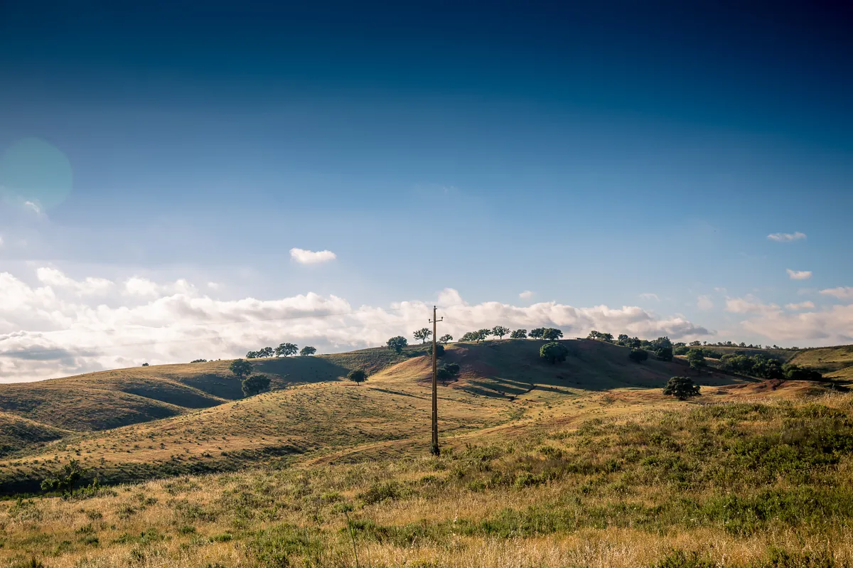
Cork, holm and arithmetic of absence
Scatter the 633 residents across a chessboard of white-washed homesteads and the maths is stark: 37.9 % are over 65; just 6.5 % are under 14. The montado rolls in gentle swells, cork oaks stripped to cinnamon waists every nine years, holm oaks offering acorns to free-ranging black pigs. Rust-coloured outcrops of xisto poke through the underbrush; stone water-holes sit lid-deep in cold shadow. The Atlantic lies 35 km away, but winter dawns still arrive Atlantic-soaked: fog lifts off the Mira valley and sheathes the trunks like grey silk. Protected by the Southwest Alentejo and Vicentine Coast Natural Park, building licences are rarer than black vultures; mass tourism never made it past the barrier.
What the cafés-mercado still cooks
Provenance is non-negotiable. Lamb labelled Borrego do Baixo Alentejo IGP arrives from flocks that graze the same parcel of cork shade their grandfathers did; the shoulder is roasted over holm-oak logs, cracked garlic and pennyroyal crushed into the fat. Queijo Serpa DOP, a thistle-rennet ewe’s cheese, is sliced while still cool enough to hold its butter-yellow paste. Sweet potato from Aljezur, technically coastal, slips into pastries flavoured with orange zest and fennel pollen. In the combined grocery-bar – the parish’s only shop – clay amphorae of green-gold oil stand on the counter like household gods; smoked chouriço hang overhead, tasting of bay and late-autumn paprika.
Walking the absence
There are no viewpoints, no ticket booths, no gift shops. The Rota Vicentina’s circular trail PC13 sets out from the dam, crosses the Mira on an eighteenth-century bridge mistakenly called Roman, then climbs through 10 km of uninterrupted oak canopy. What you get is negative space: a boot scuff on ochre earth, the iodine snap of rockrose after rain, the slow gyre of a Bonelli’s eagle above the ridge. Wild boar root at dusk; nightjars churr after first moonlight. Five places to stay – two country houses, a lakeside boutique quinta, a converted primary school – operate on the understanding that Wi-Fi is optional and silence is part of the rate.
Evening brings the oblique gold that painters call “hora alentejana”. The church bell tolls six; sound travels four kilometres across the un-electrified dark that still characterises half the parish. Electricity arrived here only in 1974, carried on cement posts along the same dirt tracks that once took wheat to the river quay. The echo fades, replaced by owls and, somewhere farther off, the lowing of a cow that has never seen a motorway.