Full article about Souto: Where Time is Struck by a Mountain Bell
Granite cottages, Roman trails and smoked-ham air in Gerês-border Souto
Hide article Read full article
Where the Church Bell Measures the Day
The bell in the chapel of São Vicente strikes the hour and the note ricochets down a gorge so tight it feels carved by a chisel. In Souto the clang mingles with the hush of the Rio Homem sliding over granite that has been satin-polished since the Iron Age. Behind slate roofs, oak smoke leaks from stone sheds, threading the air with the same resinous scent that cures the hams hanging like dark bats from the beams.
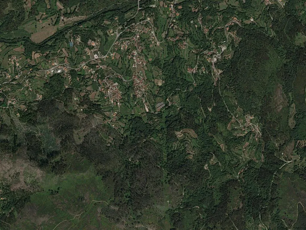
The parish covers barely four square kilometres, pinched between the Serra da Amarela and the Serra do Gerês. Of its 461 residents, more than a quarter are over sixty-five; mornings begin with the scuff of wooden clogs on uneven cobbles, the clink of galvanised pails, doors groaning open to release a curl of wood smoke. Children – only fifty-six of them – provide the counter-rhythm: bicycles toppled against schist walls, football shouts rebounding off the 17th-century pillory in the square.
The Gate to the National Park
Souto sits at 167 m above sea level on the southern lip of Peneda-Gerês National Park, the only Portuguese reserve with UNESCO biosphere status. From the last granite cottage a footpath climbs steadily into oak forest where the air thins and the temperature drops five degrees in the shade of hundred-year-old Quercus robur. Way-markers here are carved granite posts – no spray paint – and within twenty minutes you meet the Roman road that once funnelled gold from the mines of Braga to Astorga.
The village is an official stage of the Caminho da Costa; pilgrims bound for Santiago stop to refill aluminium bottles at the granite fountain where water emerges at a constant 9 °C. Ten guesthouses – all converted casarões with exposed stone and hand-hewn chestnut beams – offer beds from €35, breakfast included. Wi-Fi is patchy; phone reception depends on which mountain the clouds are sitting on.
Calendar of Fire and Wax
Time is organised around four feast days. The Festa de Nossa Senhora do Livramento (late August) turns the tiny square into an open-air dining room: long tables dressed with paper flowers, vinho verde poured from green glass jugs, and cod fritters arriving in wicker trays straight from the iron skillet. Mid-September brings the Romaria de São Bento da Porta Aberta: candle-carrying processions climb 400 m to the mountain chapel, the wind snatching at flames while antiphons drift across the ridge.
In winter kitchens, cooks whisk Minho mountain honey – DOP-protected since 1996 – into warm coscorões and drizzle it over thick slices of fried bread. The local vinho verde, bottled in squat glass garrafões, is slightly cloudy with a snap of malic acid that cuts through the smoke-cured chouriço served on freshly baked corn broa still steaming from the wood oven.
When darkness falls, the valley deletes itself. Without a single streetlamp for three kilometres, the Milky Way unfurls like spilled sugar across the granite crests. The only sounds are a distant dog and the river’s unending inhale-exhale against the stones – the mountain breathing through the night.