Full article about Valdosende: Gerês Gorge’s Secret River-Beach Hamlet
13th-century toll-bridge, alpine plunge-pool, goat-roast Sundays—Valdosende hides inside Peneda-Gerê
Hide article Read full article
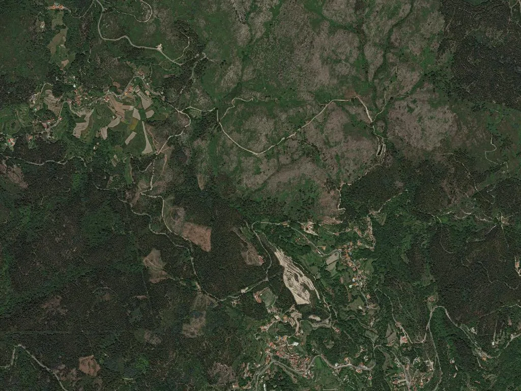
The Homem river slips between granite boulders the colour of weathered pewter. At 385 m, Valdosende straddles the cleft it has carved on the southern lip of Peneda-Gerês National Park, where the gorge widens into shingle beaches and the footpaths climb towards high summer pastures.
The valley that once was a road
Vallis de Senda – the valley of the path. In the 13th century this corridor was the only sensible way from Braga to the Spanish border; the hamlet grew up as a toll-point and forge. The single-arch Ponte de S. João still does the job it was built for in 1250, despite villagers insisting the devil lent a hand after losing a bet with the mason.
Parish status arrived in 1544, carved out of Rio Caldo. Inside the mother church one nave, whitewashed walls and a gilded Joanine retable that catches the 9 a.m. sun every Sunday. Next door, the chapel of Nossa Senhora do Livramento keeps its 18th-century azulejos under lock and key; ring the sacristan’s bell and he’ll fetch the key from the kitchen. In the churchyard a 1786 crucifix shaped like a stone sarcophagus throws a shadow long enough to sit in.
Between water and height
From the river at 200 m to the ridge at 900 m the landscape flips in 6 km. Valdosende’s river-beach is deep enough for a proper swim even in August, but the water stays alpine – locals dive in before nine, while the sun is still climbing the canyon walls. A 12 km green-cycle track, tamped limestone and barely a 3 % gradient, runs east to the Mata de Albergaria oak forest; hire bikes at the café opposite the bridge.
The Currais footpath (8 km, 3 h 30 min, red-and-yellow waymarks) starts behind the cemetery, climbs through holly and birch to the stone huts where cows spend July and August. Carry water – no springs. Fifteen minutes up the road, the Arado waterfall has boardwalks that squeal like bagpipes when wet.
What the high ground tastes of
O Abade keeps a wood-fired oven solely for kid goat; two sittings on Sunday, book ahead. Winter means turnip-root soup thickened with last summer’s dried beans. Quinta da Lama’s Alvarinho is poured at the quinta on Friday evenings – text ahead for a place at the table. For goat’s cheese, continue past the turning for Albergaria until you see the ruined watermill; Mr Armindo keeps wheels submerged in brine and sells by weight.
Festivals the river remembers
First Sunday in May: a flotilla of flower-decked boats carries the statue of Nossa Senhora da Livração upstream – arrive by 09:30 to watch the launch.
July: the overnight pilgrimage to São Bento da Porta Aberta sets off at 06:00 from the church door; take food, the 12 km climb to the sanctuary takes four steady hours.
September: Santa Eufémia’s fair fills the churchyard; dinner tickets from the bakery on Friday.
Saturday mornings: the Aviso watermill grinds maize when the sluice is full, wheels creaking at 11 a.m.; entry free, flour for sale.
When evening comes the Homem keeps talking. Visitors reverse down the lane, cottage lights click off, the bridge stays exactly where it has always been.