Full article about Sarnadas de São Simão: Slate, Silence & 5 Souls/km²
Walk Sarnadas de São Simão for sun-baked slate, empty Via Lusitana trails and a silence so wide you hear rock-rose breathe.
Hide article Read full article
The Afternoon Sun on Slate Rock
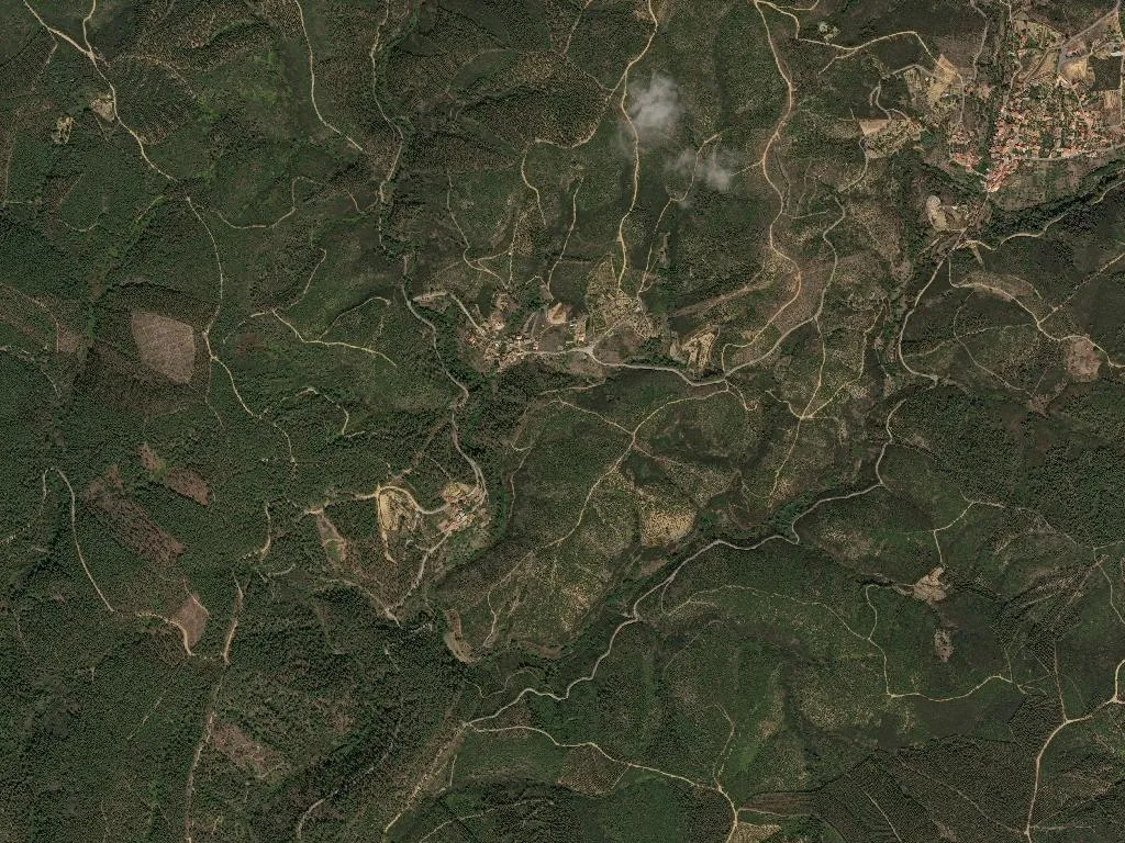
The afternoon sun beats down on the slate rock, radiating a heat that rises from the slope as if it were coming from within the earth itself. In Sarnadas de São Simão, silence is not the absence of sound—it is space, more of it. The wind cuts through the valleys at 479 metres, carrying the scent of warm earth and the low murmur of water running between boulders. One hundred and sixty-seven people are scattered across 3,100 hectares. Do the maths: five souls per square kilometre. The territory breathes wide, yes—but it breathes alone.
What makes this place different?
It is one of the emptiest corners of Oleiros parish. Walk through the village and you’ll see granite-and-slate houses, some still lived-in, others shuttered since the turn of the century. The five children who live here know one another by name. Of the 167 residents, 82 are over 65. Those who remain can trace every bend in the track, every spring, every tree that marks a boundary between smallholdings passed from parent to child for centuries.
Inside the Geopark, but no theme park
Sarnadas sits within Naturtejo Geopark, the territory Unesco pinned to its global map. Forget gift shops. Think slate glittering like cats’ eyes, olive groves clinging to gradients they were never meant to occupy, rock-rose releasing Mediterranean resin when the sun climbs. The light shifts hourly: honeyed at dusk, razor-sharp at noon, dissolved entirely when mist wells up from the valley floor. Walking here demands calves and patience. Every dry-stone wall is a quiet manifesto against forgetting—someone once stood in rain or glare, stacking slate to claim a field or halt a slope.
The Camino passes through—but pilgrims must adapt
The Via Lusitana cuts straight across the parish. Outsiders arrive to find zero way-marking, no services, distances measured in boot-hours rather than kilometres. What they do find is a silence extinct almost everywhere else. A bed for the night, too, if they ask politely. Locals won’t bite, but neither are they waiting for you.
What you eat (when you eat)
There are no restaurants—only kitchens. Beira Baixa’s protected-varietal galega olives grow in groves that still survive; the oil that trickles from the press is low in acidity and tastes of green fruit. The region’s IGP kid grazes on thyme and cistus; in village ovens it is roasted over oak with potatoes that drink every last drip of fat. This is not Instagram cuisine. It is food made by people who work the soil and understand the virtue of waiting.
How to arrive (and why you should)
The road corkscrews between slate and sky. Up here the wind never drops—it is the same wind that trains the olive trees to bow in one direction, as if listening to distant music. When the sun slips behind the Serra da Gardunha, the stone flares ochre for the length of a cigarette. That is all. No selfie sticks. Just pay attention.