Full article about Pombeiro da Beira Reclaims Its Town Status in Misty Arganil
Hear the bell ring over lime-wet granite as 32 hamlets stir beneath pine-dark slopes
Hide article Read full article
A Bell Rings Over Wet Plaster
The bell of Igreja Matriz clangs above a churchyard still wrapped in scaffolding, new lime mortar gleaming against sixteenth-century granite doorframes. Pombeiro da Beira wakes reluctantly: a thread of wood-smun curls from a chimney in Roda, the stream that gives Salgueiral its name mutters downhill, and around the old May-Fair square steel hoardings fence off the latest round of EU-funded make-overs. In December 2024 the settlement recovered the title of “vila” – a formal town – almost two centuries after 19th-century reformers erased it from the map. The 903 residents, however, never stopped using the word, stubbornly, affectionately, as one keeps a birth certificate in a drawer.
A Story Spelt in a Coat of Arms
The name comes from the wild service tree, the pombeiro, once common on these slopes that tilt toward the Rio Ceira. Manuel I granted a royal charter in 1510; the parish kept its own pillory, court and tiny jail until liberal governments abolished the municipality in 1836. When a modern coat of arms was approved in 1996 every layer of that past was stitched in: pine, doves, the heraldic wedges of medieval lords. The mother church – now a listed building – has just received €25,634 from the Centro Regional coordination board; half the façade is netted in scaffolding, but the Manueline doorway remains open. Inside, cold stone drinks the echo of footsteps, light slips through nineteenth-century glass, and oak pews creak under the weight of someone lighting a candle or simply sitting still.
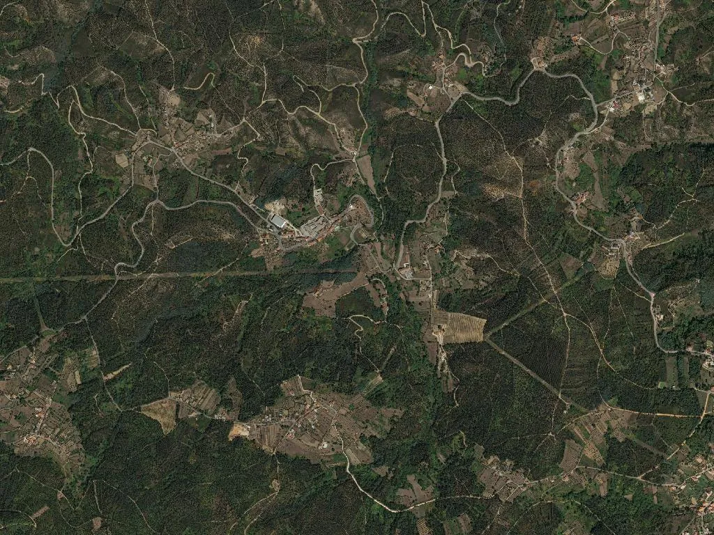
Thirty-Two Hamlets, One Parish
Pombeiro da Beira spreads across 32 km² of schist and granite, stitching together almost thirty-two named places – Roda, Covais, Picadoiro, Salgueiral – linked by dirt roads where GPS hesitates and 4G gives up. At 27 inhabitants per km², solitude is the default: lone houses among pine plantations, maize terraces, vegetable plots walled in loose stone. The arithmetic is unambiguous – 371 residents over 65, only 71 under 20 – and it reads in rusted gates, collapsed roofs, orchards run wild. Yet the constellation still burns: lights switch on at dusk in scattered clusters, and from the ridge above Salgueiral the night resembles a low, wide star map.
Four Mountain Ranges in One Sweep
The miradouro at the tiny chapel of Santa Quitéria sits only 194 m above sea-level, but the ridge behind climbs fast. From the granite outcrop the view fans east to the glacial shoulders of Serra da Estrela, south to the quartzite bulk of Serra do Açor, west to the forested silhouettes of Caramulo and Lousã. The wind smells of resin and hot gorse; kestrels hang in the draught. Immediately below, the Barragem das Fronhas stretches a blade of water between schist banks – a ten-minute spin from Roda, popular with carp anglers and evening strollers when low sun ignites the surface. Walk twenty minutes north-east and the Barreiras do Picadoiro appear: pink-and-white sandstone fluted into razor-edged fins – a ready-made set for close-up geology. (Local habit: leave an empty beer can on the viewpoint wall. A small cairn of tins is growing. Nobody explains why.)
Cheese, Lamb and Dão in the Glass
The parish sits inside four protected-food catchments: Serra da Estrela DOP cheese and its cloud-like fresh requeijão, Serra da Estrela PDO lamb, and Beira Alta IGP apples. In the two tascas that open without ceremony, the cheese is spooned onto rye, roast lamb arrives with rosemary and wrinkled potatoes, apple wedges finish the meal or reappear in local aguardiente. The Dão wine region laps this far north; proper tastings happen 13 km away in Arganil, where small shops stock Touriga Nacional and barrel-fermented Encruzado. Among the eight legal lodgings – a mix of village houses and B&B rooms – breakfast means warm bread, fresh requeijão and apricot jam made by someone’s aunt.
What Lingers
When the church scaffolding comes down and the May-Fair square is re-laid, Pombeiro da Beira will still ring its midday bell, still smell of oak smoke, still sprawl across hamlets no tourist leaflet has ever listed. What stays with you is not a postcard vista but the squeak of a wooden gate in Roda, the damp chill of Manueline stone under your palm, the peppery finish of aged ewe’s-milk cheese, and the wide silence from Salgueiral’s ridge – where four mountain ranges meet on the horizon and the wind never quite stops.