Full article about União das freguesias de Rio Torto e Lagarinhos
Follow the twisted stream through Gouveia’s hidden Serra da Estrela villages, tasting thistle-rennet
Hide article Read full article
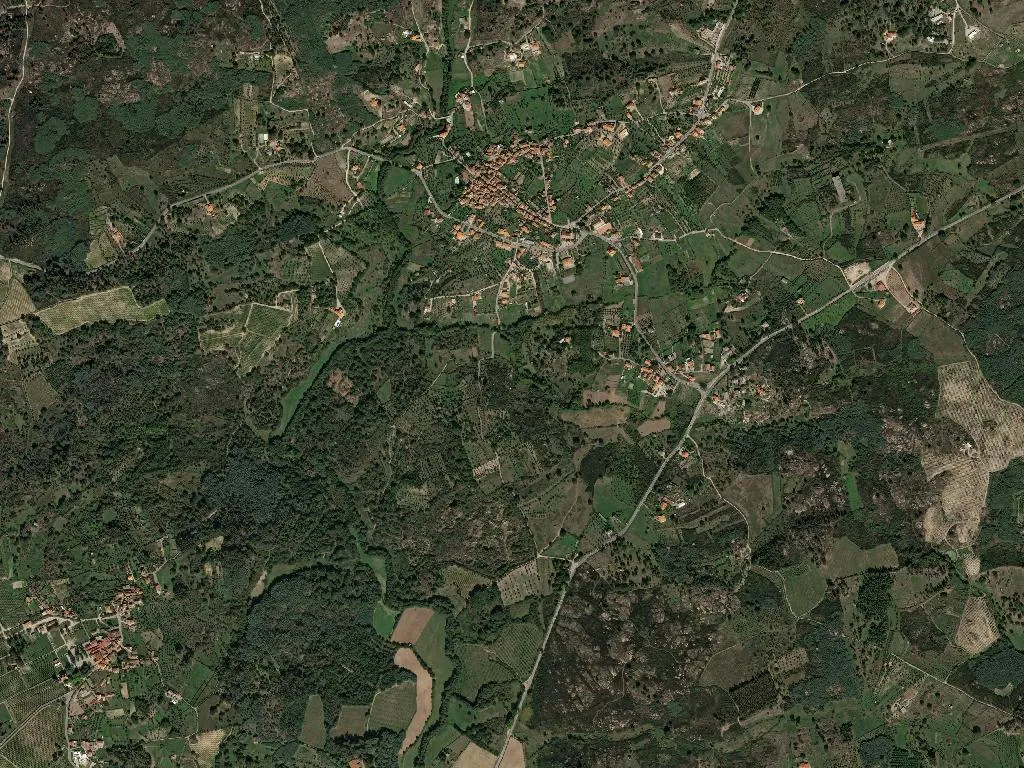
The stream speaks first
You hear the water before you see it—a low, steady hush that follows you through the hamlets of Rio Torto and Lagarinhos. The name of the stream is literal: the water twists, coils and doubles back on itself, sewing the two villages together at 422 m on the southern flank of Portugal’s highest range. Between them they hold just under 2,000 ha of Serra da Estrela Natural Park, a landscape paced by melt-water, transhumance and the slow turn of seasons.
Names that stick
Rio Torto owes its label to the contorted river that shaped its lanes, its single-arched stone bridges and the pocket-handkerchief fields squeezed between granite banks. Lagarinhos keeps the memory of communal olive and grape presses—lagares—once powered by the same current. An administrative merger in 2013 merely rubber-stamped what geography had long decided: shared ridge-lines, January air sharp enough to slice bread, and the honey-coloured September light that gilds the heather.
Knowledge in residence
The head-count is 745, and the ledger tilts towards age: 247 seniors, 60 under-25s. Yet the imbalance concentrates know-how. Ask in the café and someone will still thistle-rennet a Serra da Estrela DOP wheel by hand, recall the old smugglers’ path to the glacier valley, or read the wind’s shift that announces snow in the couloir.
What the table remembers
In cool cellars the same cheese softens to a buttery paste; the requeijão spreads like clotted cloud across warm broa. Feast-days bring Leitão da Beira IGP or Serra da Estrela PDO lamb, grass-scented and slow-roasted in a wood-fired oven. Local olive oil—either Beira Alta or Beira Baixa DOP—sluices over new potatoes and winter greens, while an iron-rich red, tasting of the same granite that terraces the vines, anchors every meal.
Footnotes in stone
Because the parish sits inside both the natural park and the UNESCO Estrela Geopark, every walk doubles as a lesson in deep time. Trails climb from schist riverbeds to 540-million-year-old glacial pavements, then drop into oak woods where the only sound is a branch giving up under the weight of snow. In summer the streamside alders throw cool shade over swimming-sized pools; in winter the same water glazes the cobbles like dark glass.
Five keys, one bell
A lone monument—classified in 1978 as a building of public interest—keeps watch from a knoll. Beyond it, five small guesthouses have opened in restored field-stone cottages. Wake to a rooster that has no snooze button, feel dawn strike the whitewash, then follow the smoke from chimneys straight up into December’s stalled air.
Density as luxury
At 38 inhabitants per km², space is the surplus crop. Cattle graze the bogs that blush green every April; allotments are ruled into neat rectangles of kale, turnip and dwarf beans. When the sun slips behind the ridge and shadows pour over terracotta roofs, the smell of burnt oak and freshly turned loam drifts uphill—an announcement, in case you had forgotten, that the land is still being read aloud.