Full article about Guadalupe
From 1538 Mexico-carved cedar to Pentecost soup, life still circles the bell tower
Hide article Read full article
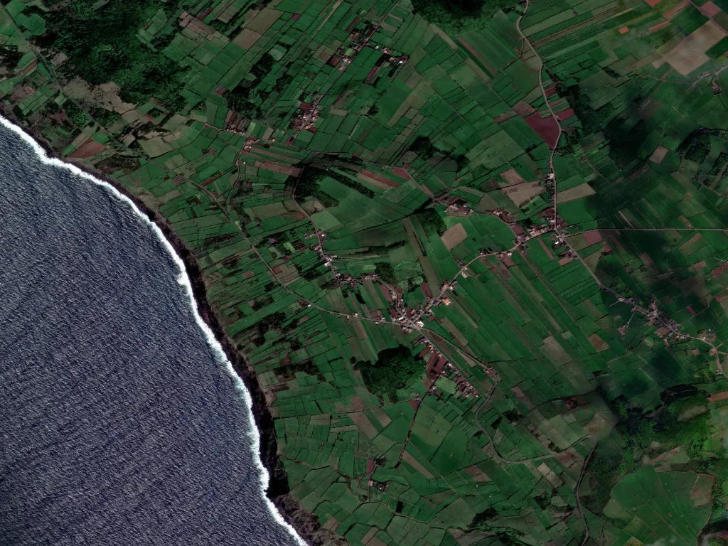
When the fog lifts, Guadalupe starts the day
Morning arrives reluctantly in Guadalupe. Until noon a low mist clings to the parish’s rare level fields, then rolls back to reveal pastures the colour of oxidised jade that run west to the ridge. The Atlantic is less than three kilometres away; you taste it in the north-westerly wind long before you see it. At eight, twelve and seven the church bell tolls, a schedule Fr José Maria has observed since his appointment in 1998.
A name shipped from Mexico
The settlement was granted town status on 27 March 1546, but devotion arrived earlier. Between 1540 and 1542 masons raised a chapel to house a cedar image of Our Lady of Guadalupe brought from Mexico in 1538 by Domingos Pires da Covilhã. The 1553 deed, still bound in the parish archive, offered land to anyone who planted vines and built a stone house with a tiled roof—an incentive so effective that by 1864 the population reached 3 048, a figure now stencilled on the north wall of the Império do Espírito Santo.
The arithmetic of Pentecost
Three Holy Spirit chapels—Guadalupe, Beira-Mar da Vitória and Santo António da Vitória—govern the year. Coronation Sunday falls on Pentecost: at nine o’clock the women of the brotherhood ladle beef soup into enamel bowls in front of the church. The recipe is public knowledge—120 kg of beef, 80 kg of corn bread, 50 litres of island white. In 2023 the 8 kg silver crown was carried by two teenage girls from the community centre; for the first time no male volunteers stepped forward.
Basalt and potato drills
The plateau is basalt, the soil andosol, still responsible for forty per cent of the potatoes eaten on Graciosa. The regional road ER1-2 bisects the parish, but to see the fields you turn off onto Canada do Rocha where dry-stone walls rise two metres against the wind-blown volcanic grit that scorches young shoots. At the foot of Serra das Fontes the 1977 public well remains unlocked; the key hangs in the house of Sr Joaquim, who inherited the duty when his father died.
The ledger in reverse
Of 987 residents, 232 are over sixty-five. The primary school closed in 2009—only six pupils remained—and the morning bus now leaves at 07:20 for Santa Cruz. The parish council has turned Dona Rosa’s old grocery into a weekend rural tourism post selling raw-milk cheese from just two households, the Melos and the Silveiras. In 2022 births numbered three, deaths fifteen. A GP visits on Mondays; anyone needing a specialist catches the dawn ferry to Angra do Heroísmo.
What is still here
Begin at the parish church: the 1718 gilded altarpiece was paid for with Pico salt-money by captain-major Mateus da Câmara. From the churchyard you look over the walled cemetery—438 graves, the earliest dated 1834. Walk Rua do Vale to Canada da Piedade: fifteen houses stand empty, but at number 32 Albertina still fires her bread oven on Saturdays, selling rye-and-corn broas for a euro apiece. Where the tarmac ends, the mixed trail PR1 reaches Furna do Enxofre’s sulphur cavern in twenty minutes, yet most hikers drive straight past. Café O Pescador opens at 07:30, pulls espresso for sixty cents and locks its door at 16:00 sharp. Afterwards the only sound is the bell counting the hours for whoever is still listening.