Full article about Sunset Cliffs & Concrete Chapels of Ponta do Pargo
Where Madeira’s westernmost lighthouse meets a raw-concrete church above Atlantic-whipped basalt
Hide article Read full article
Where the Land Falls into the Atlantic
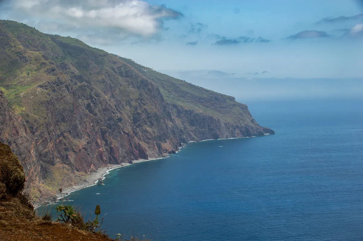
The Atlantic swallows the sun inch by inch, lacquering the horizon in molten copper and garnet. At Madeira’s westernmost fingertip, 290 m above the breakers, the Ponta do Pargo lighthouse stands blade-sharp against the glare — a white tower on duty since 1922, warning ships that the island ends here in a basalt wall. Salt crusts the air; low cloud drags its belly across the plateau, releasing a fine mist that tastes of lava and brine. Look west and there is nothing but water and weather until Newfoundland.
Behind the lighthouse, the parish unrolls across 24 km² of wind-polished basalt at an average height of 689 m. Only 803 souls share the space — a density lower than the Shetlands — scattered among hamlets whose names — Torre, Trincheira, Pedregal — read like lines from a medieval charter. Someone in the 1700s thought the headland resembled a red porgy; the nickname stuck, and the parish only cut loose from neighbouring Fajã da Ovelha in 1954. Generations have learned to husband thin soil and thick gales, pinning potatoes and vines between stone walls that lean 20° into the weather.
A Church that Thinks it’s a Lighthouse
In Torre, the parish church of Santa Cecília refuses to behave like village architecture. Opened in 2011, it is the work of local architect Luís Jorge Santos: a raw-concrete beacon with a glass lantern-top that answers the real lighthouse three kilometres away. Inside, daylight ricochets off white render and birch pews; outside, the profile is all right angles and resolve. Musicians’ patron Saint Cecilia is honoured on 22 November, but the bigger draw is 15 August — Nossa Senhora da Graça, nicknamed the Day of the Seven Ladies, when the churchyard fills with marizéiros (traditional strings) and the scent of grilled espada (black scabbardfish) drifting up from temporary coal barbecues.
Below Trincheira, a stubby stone cylinder dating from 1874 marks the last lime-kiln still standing. Limestone was once burned here for mortar; men emerged ghost-white, lungs rasping, to daub the walls that still keep the Atlantic out. The Regional Government has listed the structure, though its trade vanished decades ago.
Cliffs, Waterfalls and a Secret Beach
Ponta do Pargo is the gateway to Madeira’s only sea-level trail reachable without a boat. The Vereda do Pesqueiro zig-zags 400 m down an almost vertical cliff — steel cables and boot-polished basalt steps — to a rock platform where local anglers still cast lines into 1,000 m of water. Each switchback reveals a new geometry of lava dykes and spray.
A 20-minute drive east, the Cachoeira da Garganta Funda slips 140 m in a single silver thread, evaporating mid-air when the trades are strong. Park at Pedregal, follow the 600 m tunnel of laurel and fayal-heath, and the roar widens into a amphitheatre of moss-slick walls where moisture beads on eyelashes.
Closer to sea level, Europe’s highest cliff-lift drops 250 m in four cinematic minutes to Fajã dos Padres, a sliver of Jurassic coastline owned by the Jesuits until 1759. Today it is a working smallholding: banana palms rustle, Malvasia vines are trained on trellises, and you can drink the result at lunch before swimming off black-pebble shelves. The temperature rises five degrees the moment the doors open; suddenly you’re in the subtropics while the lighthouse still blinks through cloud above.
Light in the Dark
Dusk comes quickly on the plateau. One by one, sodium lamps flick on, outlining a scatter of smallholdings; the census records 232 residents over 65, only 80 under 14. Yet the place holds: new drip-irrigation hoses glint between terraces, and the café in the village square still serves poncha at 10 a.m. When full darkness arrives the lighthouse resumes its metronome — four white flashes every 20 seconds — reassuring whoever is out there that this fragment of basalt, 622 km from the African coast, remains insistently, stubbornly, land.