Full article about Serra de Água: Madeira’s corkscrew road & 1901 hydro light
Feel Serra de Água’s 1852 hand-cut tunnel, spiralling ER104 and 1901 hydro station still lighting Madeira nights.
Hide article Read full article
A road that coils like a thrown ribbon
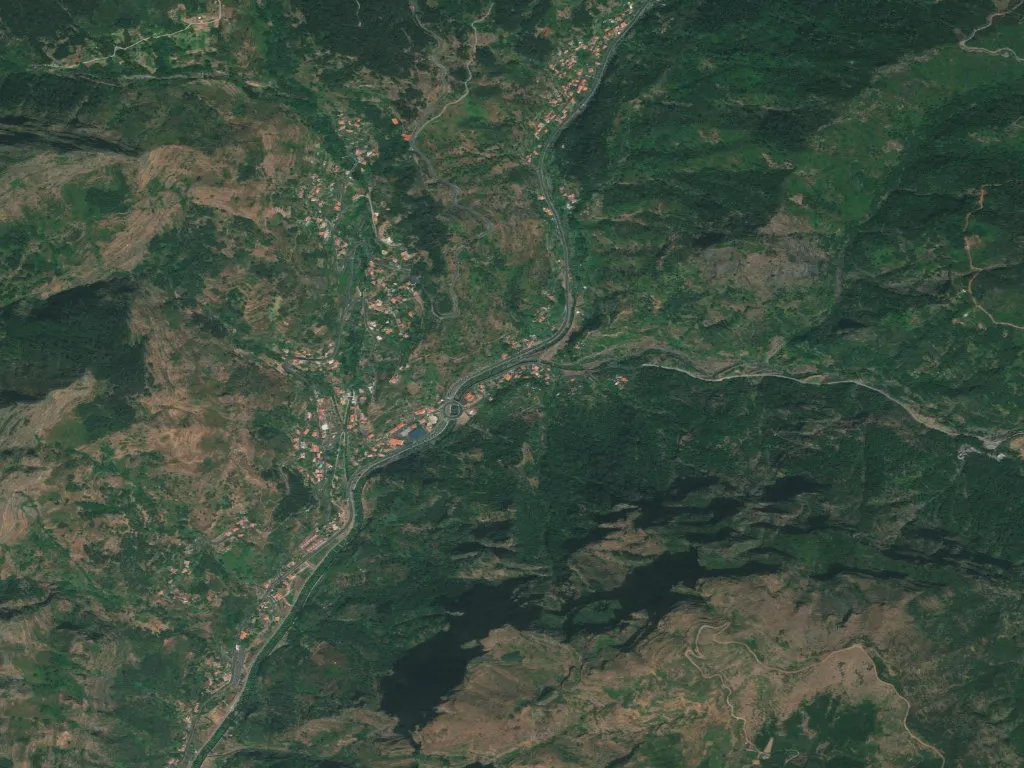
The ER104 corkscrews through mid-air, a concrete helix pinned to basalt cliffs 360 m above the Atlantic. From the passenger window the valley floor seems to inhale: terraced vineyards slide downwards, laurel leaves drip off the retaining walls, and the Ribeira de Serra de Água keeps up a low, ceaseless commentary beneath the road noise. This is not scenery you glance at; it is geography you feel in your diaphragm.
Chiselled by hand
In 1852 labourers swinging short-handled picks began hacking a 1 km throat through the mountain to let ox-carts shuttle between the island’s sun-scorched south and the dripping north. What took them two years a modern drill could manage in a week, but the original hand-cut tunnel still carries traffic, its walls bearing the tooth-marks of 19th-century graft. Above it, 1960s Portuguese engineers looped the highway in a four-storey spiral, a piece of infrastructural origami that still makes lorry drivers cross themselves.
Halfway down the spiral the village reveals itself: a grey-stone church tower, a rectangle of red-roofed houses, and a watermill wheel that turns only when the ribeira is feeling generous. The parish church, rebuilt in 1750 after a landslide took the first nave, keeps its Manueline doorway; inside, a 1520 Flemish panel of the Virgin is lit by the same Atlantic light that silvered the sails of early caravels.
Where water became watts
While London was still arguing over alternating current, Serra de Água built Madeira’s first hydro-electric station. Opened in 1901, the stone powerhouse just below the bridge fed Funchal’s new trams and streetlights with the energy of falling water. The turbines, supplied by a German firm that also outfitted Nile dams, still hum on feast days when the utility company runs the plant for demonstration. A single 50 kW dynamo is enough to illuminate every house in the parish twice over—proof that sustainability arrived here before the word existed.
Walking on water
The Levada do Norte enters the village under a moss-coated aqueduct and then thinks better of the road, ducking instead into a tunnel of laurel and Madeira blueberry. For five kilometres the path is a narrow stone gutter at ankle height, water so clear you can count the tadpoles. Every 200 m a sluice gate lets farmers flood a terrace of bananas or root vegetables; the system, mapped by the Moors and perfected by 16th-century colonists, is still policed by a part-time levadeiro who tours on a Honda moped with a wrench and a roll of gaffer tape.
Above the treeline the track reaches the Boca da Encumeada, a wind-scoured pass at 1 007 m where the island folds in half. Stand still and you can watch weather systems collide: clouds climb the southern scarp, unroll across the saddle, and dissolve into sun over the northern cliffs like a time-lapse film.
Geometry of subsistence
From the miradouro the agricultural maths is visible. Vineyards occupy every ledge angled south-west; the rows run exactly 1.2 m apart, the width of a traditional vintage basket. Abandoned stone lagares—circular troughs where barefoot treading once took place—now serve as herb gardens for the village café, their granite lips warm from afternoon sun. Above 600 m the terraces give up and the native laurel forest reclaims the ridge, a UNESCO-listed canopy that keeps the air permanently at dew point.
Population density here is 40 souls per km², low enough that a dog’s bark carries across two valleys. The 973 inhabitants include a part-time saxophonist who teaches Lisbon tourists via Zoom, and a civil engineer who returned to run his grandfather’s mill now geared to producing small-batch rye flour for Funchal bakeries.
Echo check
Twice a day the yellow interurban bus drops out of the clouds in low gear, brakes exhaling. As it descends towards Ribeira Brava the driver taps the horn—one long, two short—so that anyone waiting at the bend can finish their coffee. The sound ricochets between basalt walls, multiplying until it resembles a ship’s horn lost in fog. By the time the echo dies the valley has reset itself: water over stone, wind through heather, the faint metallic taste of electricity in the air.