Full article about Caniço: Black-lava lido meets Atlantic glare
Ride a cliff-hugging lift to salt-slick lava lidos in Madeira’s Caniço, where reeds once waved.
Hide article Read full article
The glass elevator at Lido Galomar free-falls 200 m down a near-vertical fault line. As the cabin descends, the Atlantic’s colour dial clicks from deep-indigo to a jewelled, almost viscous turquoise that seems to fill the entire visual field. When the doors part you are standing on a black-lava lid, saltwater lapping at your ankles and the morning sun already warming the basalt until it smells faintly of hot iron. This is how Caniço announces itself: a dark geological wall, the ocean nipping its heels, and a glare so bright you walk around half-squinting.
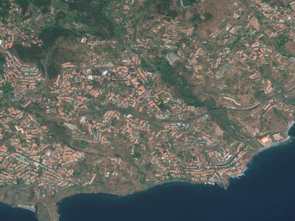
24,000 neighbours on a handkerchief of land
Covering barely 12 km², Caniço is the most densely populated parish in the municipality of Santa Cruz, yet the numbers feel theoretical the moment you either drop to the coast or climb the ridge where fennel grows wild and quail skim the ground. Daily life plays out on the upper plateau—supermarkets, schools, the parish council—while the shoreline remains a corrugated edge of cliff, pocket beach and protected reserve. The topography forbids sprawl; instead it stacks the village vertically and hides the bulk of it behind basalt walls.
The reed that named the place
When the first settlers arrived between 1438 and 1440, the valley floor was a marsh of tall reeds—Phragmites communis—and the district simply became "the reed bed", Caniço. It was one of the first three settlements outside Funchal and Machico, planted exactly on the boundary between the two original captaincies. That political fault line survives in duplicate place names: Caniço de Baixo (Lower) and Caniço de Cima (Upper), each with its own 16th-century church—Espírito Santo on the western side, Santo Antão on the east—as if faith itself had to be twinned to keep the peace.
Memory here is more than anecdote. Local historians believe Madeira’s first water-mill stood at Azenha, already turning while Zarco, the island’s discoverer, was still alive. The mill at São Jorge, fed by the Levada do Reis, still grinds maize every week; three centuries of continuous use make it the island’s last working stone mill. Stand beside the channel and you hear the wheel groan, a low bass note that vibrates through the grain and surfaces as warm, slightly damp flour.
Baroque, gunpowder and a bridge that ends mid-air
The parish church, begun in 1783, bridges late-Baroque and early Rococo. Funds ran dry, so the tower lagged behind by ninety-one years; you can read the pause in the stone’s colour shift. Inside, Nicolau Ferreira’s gilded carvings drink in lateral sunlight and throw honey-coloured reflections across the nave.
Drive five minutes seaward and you reach Forte dos Reis Magos, an 18th-century cube of lava blocks built to discourage Berber pirates. The walls still hoard afternoon heat, releasing it slowly into the evening breeze. Further north the abandoned Ponte do Faial stops dead: seven arches, 130 m long, collapsed in 1984 and were never rebuilt. The surviving pillars hover above the ravine like a sentence whose final clause has been ripped away.
Groupes that pose for portraits
Below the cliffs, the Garajau Partial Nature Reserve is Europe’s oldest underwater sanctuary (created 1986). Spearfishing has been banned for so long that dusky groupes—some the size of cabin luggage—assume divers are harmless curiosities. They drift within arm’s reach, cheeks silvered, eyes ringed in gold. Snorkellers who ride the cable-car down to Praia do Garajau float above the same basalt terraces, watching dense clouds of salema and bream pivot in unison.
Back on dry rock, both Roca Mar and Lido Galomar fly the Blue Flag. Roca Mar’s seawater pools are chiselled straight into the lava; steps cut at the turn of the millennium drop you directly into 21 °C Atlantic water that shocks the breath back into your lungs.
A dead volcano and the laurel forest at its back
The viewpoint of Pico da Atalaia sits on a spent cinder cone. From 350 m you can spin 360°: airport runway to the east, Desertas Islands floating like charcoal smudges to the south-east, and inland the UNESCO-listed Laurissilva forest exhaling its signature scent of wet leaf mould and laurel. Way-marked footpaths thread the coastal slope between Caniço de Baixo and Garajau, alternating between sun-baked basalt and tunnels of scrubby salt-resistant maquis. For something quieter, follow the levada that feeds São Jorge’s mill: stone channel, constant water, and the wheel’s heartbeat acting as a metronome for your stride.
Caniço was officially upgraded from village to town in 2000, then to "city" in 2005, yet the word still feels baggy here. What lingers after you leave is not civic grandeur but something more mineral: the thud of lava meeting water, the sub-aquatic slow-motion of groupes, and the low mechanical hum of the island itself turning grain into flour.