Full article about Santa Bárbara’s Wind-Carved Plateau, Azores
Walk basalt-walled vineyards above the Atlantic where 370 souls share silence with skylarks
Hide article Read full article
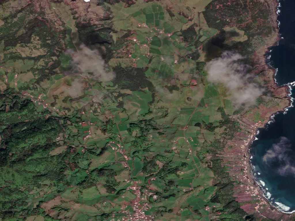
A sudden Atlantic gust flattens the grass on the ridge above Santa Bárbara. At 240 m the land rolls like a calm sea, broken only by waist-high walls of black basalt that map centuries-old field boundaries. Some 370 people occupy this wedge of Santa Maria’s northern uplands—24 souls for every square kilometre—leaving space for skylarks, dairy cows and the hush that follows the wind.
Geography
Santa Maria is the Azores’ oldest island, its Jurassic heart tilted skyward. Volcanic ash has weathered into a crimson soil, the terra rossa, that grips the roots of vines and wild clover alike. Within the Azores Geopark, the parish stakes out a wind-scoured plateau between the Ribeira de São Francisco and the island’s raw north coast, where basalt columns plunge straight into the Atlantic.
Wine
Vines arrived with 16th-century settlers; their descendants still train the low, gnarled trunks inside stone currais—tiny plots walled against salt-laden gales. The yield is too small for export: what is not bottled for the table ends up in the annual Festa do Vinho, poured alongside semi-cured São Jorge cheese and crusty pão caseiro.
Daily Life
Fifty primary-age pupils keep the single school alive; older teenagers board in Vila do Porto, 12 km south. A weekly freighter brings groceries, diesel and mail—medical emergencies mean a 20-minute flight to Ponta Delgada. Visitors come in July and August, stay in restored stone cottages, and leave the plateau to its cows, elders and the wind that will still be blowing tomorrow.