Full article about Água de Pau: Where Volcanic Soil Meets Atlantic Salt
Walk 1563 lava fields, sip sulphurous springs, taste Castelo vines above Lagoa do Fogo
Hide article Read full article
Shades of Green, Scent of Salt
The eye adjusts in layers. First the black-green cryptomeria, then the almost-neon of newly sprouted pasture, finally the white punctuation of hydrangeas that line the earthen tracks. Água de Pau inhales between São Miguel’s south coast and the serrated interior, 137 m above the Atlantic where the air arrives salted and slightly sulphurous. Its 2 919 souls occupy 1 745 ha of wrinkled terrain, scored by streams and 19th-century levadas that zig-zag to the sea.
On the Shoulder of a Dozing Volcano
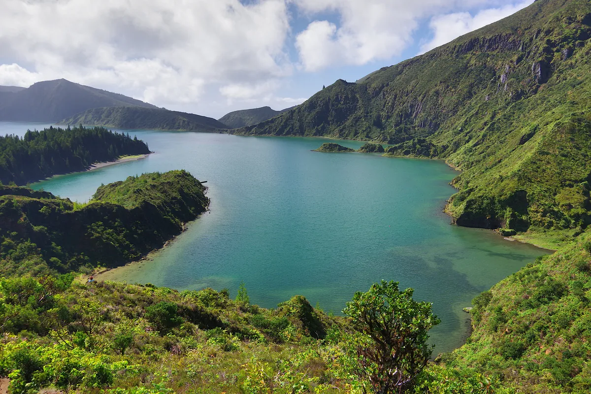
The parish sits on the western flank of the Água de Pau caldera, one of the youngest composite volcanoes in the Azores. The soil is gun-metal andesite, legacy of the 1563 eruption that threw up the Lagoa do Fogo cone. Springs such as Furna seep between dry-stone walls pieced together between 1850 and 1920, when families from the poorer uplands were encouraged to settle the mild coastal slope. At 167 people per km² houses still stand far enough apart for potatoes and yams to be grown between whitewashed walls; citrus orchards are tucked behind pittosporum hedges planted after 1950 as windbreaks. On low-cloud mornings footsteps echo on the basalt setts of the regional road laid in 1942, replacing a donkey track that once followed the clifftop.
Demography tilts young: 510 children under 14 and 386 residents over 65 according to the 2021 census. Generations converge at 11 a.m. Sunday in the rebuilt Igreja da Graça – older parishioners who remember Latin mass (discontinued 1965) and students home from Ponta Delgada’s secondary schools.
Inside the Azores Geopark
Since 2013 the entire parish has been absorbed into the Azores Geopark. A 5 km way-marked trail along the Ribeira de Água de Pau peels back the volcanic record: 1563 ash over 1652 pumice, charcoal flecks radiocarbon-dated to the mid-15th century. On basalt terraces between 100 m and 200 m, 2.3 ha of vines survive in tiny currach-style plots. The white Castelo cultivar, introduced after 1850, yields roughly 600 bottles a year, trodden in 200-year-old wooden lagares and aged in glass demijohns for Pentecost feasts that have filled the império beside the church since 1867.
Citrus with an Atlantic Accent
Oranges from the Algarve reached the island aboard packet steamers around 1850. Today 47 growers tend 11 ha of tangerina-de-massa and limão-cravinho, shielded from Atlantic gales by tamarisk hedges. The fruit carries no protected designation, yet wholesalers in Ponta Delgada still label it “citrinos de Água de Pau” – thin peel, 12–14 °Brix, a bright acidity of 0.8–1.2 %. Zest from the same fruit now flavours the island’s iconic cozido das Furnas, replacing the extinct Azorean lemon lost to 19th-century phylloxera.
Clocks Run on Church Bronze
Time is struck by the same 1927 bell, recast from bronze salvaged from Vila Franca’s old lighthouse. Bus 113 (Lagoa–Água de Pau) passes at 07:15, 12:30 and 17:45 – timetable unchanged since 1984. On the 1968 regional road, width 4.5 m, drivers honk where an 1850 wall blocks the view. No official viewpoint exists, yet from the cemetery gate at 180 m the eye sweeps from Vila Franca islet to Ribeira Quente. At dusk the village’s new LED lamps replace the sodium glow that tinted nights until 2015. By 06:30 the thermometer slips from 18 °C to 14 °C, fog thickens, and the obstinate green – fed by 1 200 mm of rain a year – resumes its silent, unpermitted growth.