Full article about Algarvia: Azores village fading into silence
Stone roofs, 240 souls, no café—Nordeste’s emptiest parish clings to Pico da Vara’s mist
Hide article Read full article
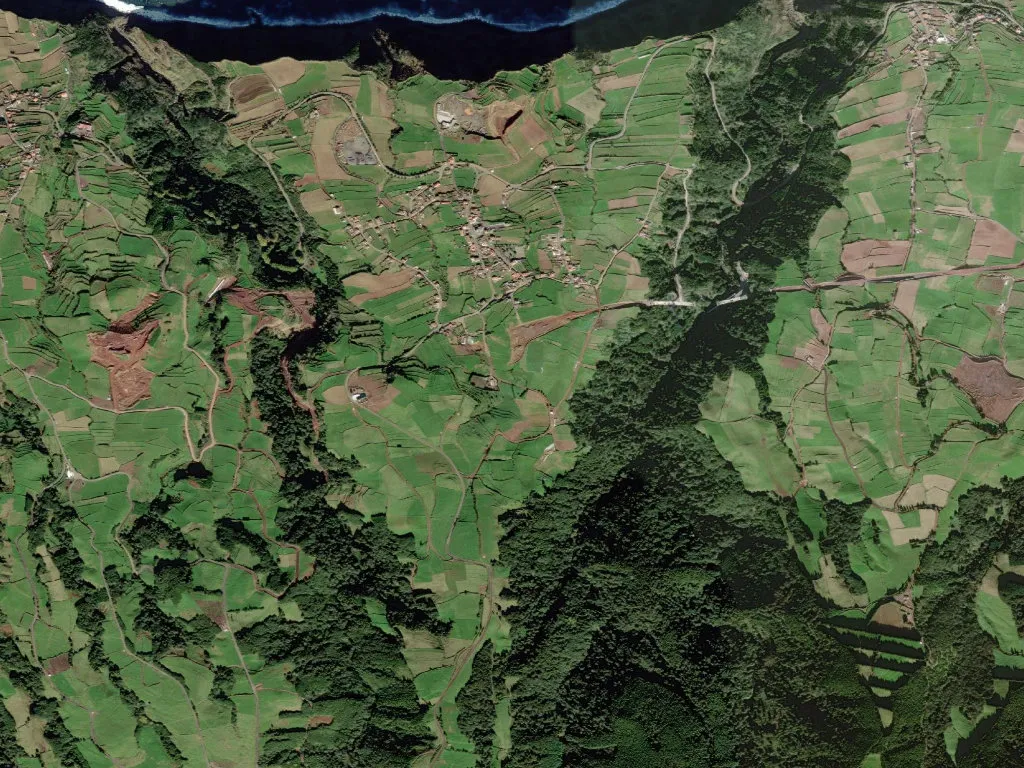
Seven kilometres of switch-backs above the ER-1-1 deliver you to Cimo da Rocha, 321 m above the Atlantic. The road is hemmed in by waist-high walls of loose basalt stacked in 1953 under a Ministry of Agriculture make-work scheme; at the crest, a breeze-block bandstand, erected in 1979, surveys a parish that has almost nothing left to survey. Only 240 souls occupy Algarvia’s 5.4 km²—44 per km², the lowest density in Nordeste and 37 % fewer than the 1991 head-count.
Geography of absence
There is no café, no pump, no ATM. Arminda’s grocery on Rua da Igreja unlocks “when the bread arrives”—three mornings a week, carried by Sr. Carlos’s van on its Wednesday loop from Ponta Delgada. The dark-basalt houses with wedged-blue doors are not folkloric replicas; they are the identical structures listed in the 1863 land registry, now roofed with corrugated cement instead of thatch. In the back gardens, 0.8 ha of pergola-trained verdelho vines still cling to the wires, the last scrap of a micro-plot that once fed into the Azores DOP “Vinhos dos Açores”, created in 2004 and abandoned here since the final grower quit in 2018.
Generational cadence
2021 census: 23 residents under 15, 48 over 65. The yellow A. França & Filhos school bus leaves at 07:05 with seven pupils—three bound for the primary in Nordeste village, four for the secondary in Povoação—returning at 17:45. The only organised activity is a Friday-evening singers’ circle in the parish-council room, a ghost of the Clube de Campo “Os Lavradores”, founded 1968, folded 2009 for want of members.
Territory of stone and water
Algarvia lies inside the Central Zone Protected Landscape and the Azores Geopark. There are no caldeiras here, only the ephemeral Lagoa do Caldeirão, a shallow, peat-rimmed pool that forms over the 1630 lava flow from Pico do Fogo and is now listed as priority habitat 3110. The main stream, Ribeira do Pelames, rises at 580 m on Pico da Vara and runs 5.2 km to the sea, feeding three water-mills—Meio, Fundo and Povoado—still logged in the 1837 council books. When the wind swings north-east, the sulphur breath of Caldeira Velha’s fumarole drifts eight kilometres across the ridge, a reminder that the island is merely dozing.
Dusk begins with the click of a light in Jaime’s house, civil-registrar from 1974-1994; next, the Bettencourt dairy glows, where 18 Friesians supply the daily churn for LactAçores. After that, darkness is total, scored only by the wall clock of the 1876 Igreja de Nossa Senhora da Saúde, whose hourly strike carries the whole valley—because nothing else is loud enough to compete.