Full article about Rosto do Cão: Ponta Delgada’s Pocket-Sized Parish
Rosto do Cão packs 4,300 Azoreans into 558 hectares of lava-strewn lanes, doorstep veg plots and espresso gossip south of Ponta Delgada.
Hide article Read full article
A parish that measures itself in hand-spans
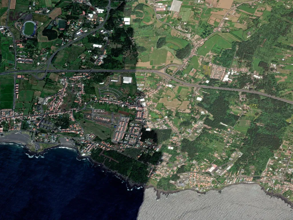
770 people per square kilometre hit you before you’ve even locked the car. Alleyways taper between black-stone walls mossy from the Atlantic, and vegetable plots lean so close across drainage ditches that runner beans practically shake hands. Rosto do Cão – officially Livramento – covers only 558 hectares, a slim volcanic shelf that drops 31 metres to the shoreline south of Ponta Delgada. Space is counted in palmos, the Azorean hand-span; front doors open almost straight onto the civic boundary.
No one can satisfactorily explain the name. “Rosto” probably refers to the low promontory that closes the southern end of Ponta Delgada’s bay; “Cão” simply appears on the first cadastral map in 1863. “Livramento” arrived a decade earlier when a tiny chapel went up to mark safe return from whale ships and from the sugar-cane fields of Hawaii. The nine-day romaria that starts every 31 August still follows the promise made by those who came back alive.
Territory of neighbours
Of the 4,307 residents (2021 census), 689 are under fifteen. They all squeeze into the two-block primary school built in 1968, patched after the 1998 earthquake that shook the island at 5.7 Richter with its epicentre only eight kilometres away. At the other end of life, 527 are over 65; they meet over 65-cent espresso at Café Santa Bárbara or Terra Nostra, where the morning paper arrives salted from the sea. Density turns the place into a village-city hybrid: A Pérola grocer has delivered to doorsteps for four decades, the pharmacy stays open until 22h, and the postcode 9500-730 is local shorthand for “just leave it on the step”.
The parish joined the Azores Geopark in 2013, yet there are no calderas to gawp at. Instead, geology surfaces in the basalt boulders that poke through Rua do Pópulo, in the hexagonal slabs paving the churchyard, in 1630 field records noting “lava stone” around São Roque. Beneath the 31-metre contour lie 3,000-year-old pahoehoe flows – thin, ropy layers that farmers still split with a mattock to plant the small, knobbly batata de São Roque, protected under EU designation since 2014.
Atlantic vineyards
Fourteen hectares of vineyard survive here; nine of them sit inside the currail “island” at Canada do Rolo. Between 1850 and 1920, dry-stone walls were raised shoulder-high to trap heat and blunt the salt-laden norte that races up the channel from Santa Maria. Almost every vine is the island’s own Verdelho – not the Madeiran sibling – tended by 22 growers registered with the regional agriculture board. Harvest swings from 35 to 50 tonnes, depending on how much rust and weevil hitch a ride from Pico. The bulk ferments at the cooperative in Biscoitos on Faial, but 600 bottles stay home. Ask Sr Agostinho at stall four in Livramento’s weekend market and he’ll reserve three for €9 each: no label, just “Rosto” branded into the cork.
The weight of quiet
At 18h the coastal ferry Gilberto Mariano sounds its horn offshore, low sun smears lime and ochre across rendered walls, and the parish exhales. Children wheel home from the skate park installed in 2020 on the blackened slab where the Cereal Company warehouse burned in 1997. On the corner of Rua do Monte and Rua de Baixo, a wall felled by an October 2019 storm still waits for its Boston-based owner and the town hall to agree on cement. The basalt retains the day’s warmth; the smell of sargassum riding the spring tide drifts over charcoal smoke from Sunday barbecues. You won’t find postcards here. What you will find is the certainty that time is not mislaid – it is simply stacked, lava upon lava, layer upon layer, holding the ground beneath your feet.