Full article about São Brás: Azores hamlet above the cloud-sea
Terracotta roofs, moss-black basalt walls and Verdelho vines at 445 m on São Miguel’s misty northern
Hide article Read full article
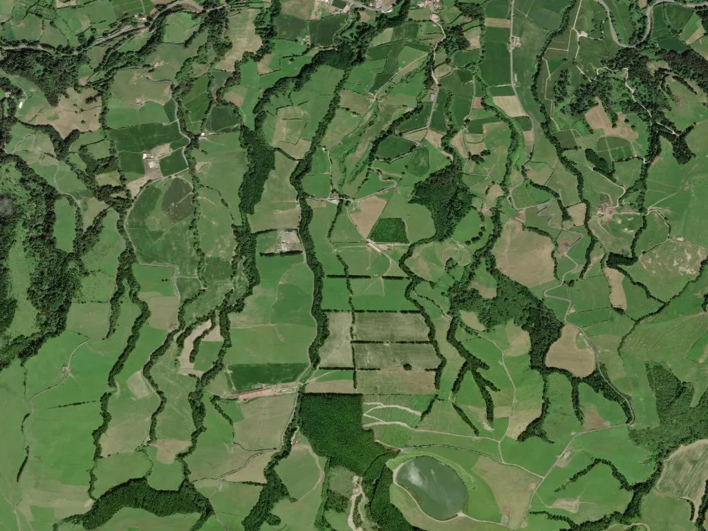
The tarmac of the ER3-2 climbs past walls of midnight-black basalt, moss threading every fissure like verdant embroidery. At 445 m the Atlantic disappears behind a rampart of cloud, yet its breath still scours the fields: a cold, salt-laced wind that keeps the grass permanently bowed. São Brás perches here on the island’s northern shoulder, a scatter of terracotta roofs caught between pasture and lava.
High-ground geography
Eight square kilometres of slope are parcelled into tiny holdings—Achada, Canada da Bezerra, Canada do Engenho—where 582 souls give a population density lower than most English national parks. Basalt boulders, prised from the ground each spring, have been stacked into hedges that last centuries; their porous skins weep condensation when the mist rolls in, which is most mornings. The parish sits inside the Azores Geopark, UNESCO-branded in 2013, though farmers simply call the rock “pó de vulcão” and use it to weigh down corrugated roofs against hurricanes.
Mid-slope routines
Demography here is almost perfectly symmetrical: 89 children under 14, 87 residents over 65. Teenagers still learn to drive tractors before cars, and primary-school lunches feature milk from the classroom’s neighbouring dairy. Average annual temperature is a cool 14 °C; rainfall tops 2,000 mm, most of it arriving as a fine drizzle that can persist for a week. When it lifts, the crater rim of Sete Cidades appears 15 km west, a ghostly saw-tooth over the cloud sea.
The logistics index—an Azorean measure of how long it takes for a doctor or spare tractor part to arrive—reads 55, just below the cutoff for “remote”. Yet remoteness is tempered by fibre-optic cable laid along the same lanes that once carried wine casks downhill on ox-drawn sledges.
Volcanic vines & island cheese
Viticulture clings to a handful of sheltered ledges where the Verdelho grape, once coveted by Russian tsars, ripens slowly under fleece-coloured skies. Yields are tiny; most wine never leaves the island, poured instead at family lunches alongside peppery olive oil pressed in Ribeira Grande.
Dairying dominates. Morning tanker lorries collect milk for the cooperative that produces São Jorge DOP cheese, its rind stamped with a crown and the word “AÇORES”. In parish kitchens, yam is diced into fish stew thickened with verdelho, and Saturday lunch at O Marineiro on the main road still means caldeirada—blue jack mackerel, saffron, tomatoes—served while the Atlantic surf you can’t see pounds the cliff three kilometres below.
When the sun drops, São Brás falls silent except for cattle bells and the wind riffling through hydrangeas the colour of Wedgwood. Basalt walls glisten as though the island itself were sweating stone; somewhere a radio flickers between fado and the shipping forecast, then settles on the voice of a Lisbon announcer promising clearer skies tomorrow over the mid-Atlantic ridge.