Full article about Ribeira das Tainhas
Black-lava fields, cedar-smoked pudding and a 474 m-high milk run on São Miguel’s roof.
Hide article Read full article
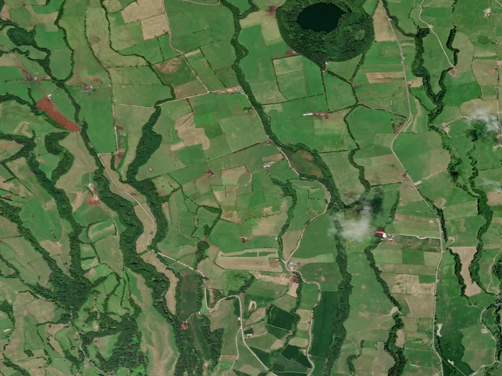
The tarmac twists upward in hairpins so tight the hedgerows brush the wing mirrors. Pasture tilts away on both sides, Friesian cattle grazing straight-laced through a drifting veil of cloud that has slid down from the rim of the island’s volcanic spine. At 474 m the air thins and cools; hydrangeas give way to cryptomeria, and every blade of grass in Ribeira das Tainhas looks newly rinsed by altitude.
Between coast and crater
With only 640 souls scattered across 959 ha, this is one of São Miguel’s loftiest parishes — a buffer zone where Atlantic brine gives way to basalt and the smell of turned earth. Farmsteads sit low against the wind, their smokehouses still threaded with the resinous scent of Japanese cedar. Inside, black-pudding coils cure over slow fires, the same way they did when whalers from nearby Vila Franca do Campo rowed out into the channel hunting sperm oil.
Lava underfoot, milk in the tank
The Azores Geopark doesn’t bother with glossy panels here; the vulcanism is under your shoes. Walk any field and the soil clings like ground coffee, fattening cabbages to cartoon size. Older residents call the fist-sized lava blocks “black cornbread”, reminders of 1563 eruptions that seared the south coast. Vines once grew at these heights — look for the knee-high stone currais that protected them from salt and gales — but the damp Atlantic climate finally conceded defeat to pasture. Twice daily a milk lorry grinds up the lane, collecting for São Jorge’s cooperative creameries or for the butter plant in Vila Franca. Sunday is not a day of rest for cows.
Life measured in visibility
Weather is the parish clock. On bad days fog swallows the road to the village; neighbours ring round before attempting the descent: “Have you left? Are the bends clear?” Ageing is a collective endeavour — 98 seniors to 78 under-25s — and traditions are maintained because there is no one to replace them. Yams are still sown in concrete irrigation tubs; pigs are slaughtered in winter to the exacting rhythm of a hand-bell; dough is carried once a week to the communal bakery where the wood-fired oven predates the 1900 earthquake. The nearest cashpoint is a 40-minute round trip when the surface holds; in a winter storm it can take an hour to cover the same 9 km to the coast.
Silence with an audience
Late afternoon, low sun fractures the cloud and spotlights the grass into molten gold. Wood smoke rises vertically; the only bell in the parish — Nossa Senhora da Conceição — tolls three times for vespers, twice for funerals. Night drops cleanly, without competition from street lamps, and the Milky Way feels close enough to snag on the cedars. At 4 °C you understand why Azoreans say their sky sits “higher” than elsewhere: the stars look pinned to a ceiling you could stand and touch.