Full article about Castelo Branco
Basalt cottages, 1672 ash fields and 11 ha of Verdelho vines above Faial’s cliff road
Hide article Read full article
The Black Glass and the White Lime
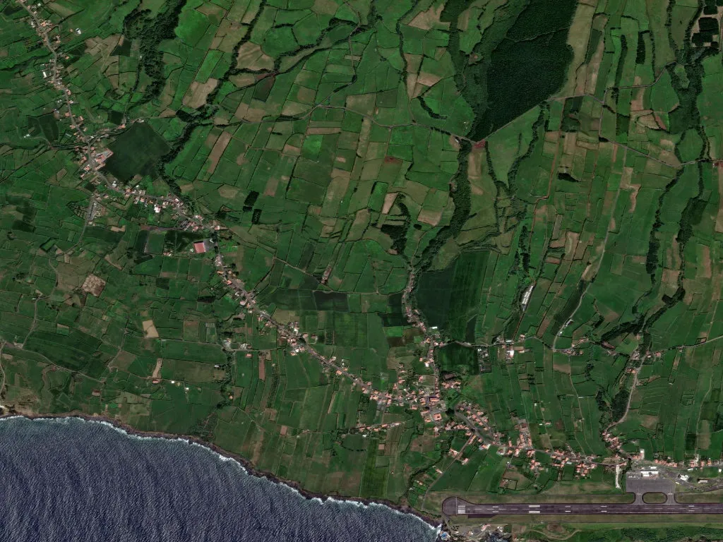
Basaltic obsidian glints against limewashed single-storey cottages, the north-westerly blowing a steady 25 km/h and lacquering the Atlantic-facing sashes with a salt crust you can taste on your lips. Castelo Branco clings to the western slope of Faial’s dormant caldera at 171 m, looking straight across the 7.5 km channel to Pico’s fajã de Santa Catarina. Only 1,258 souls occupy 23.38 km² — a density of 54 people per km², half the Azorean average — and every year there are fewer: since 1960 the parish has shed a third of its population, leaving 226 pensioners to 125 children, an ageing index of 180 %.
The name is literal: the “castle” is the 1653 fort of São João Baptista that still guards Horta’s bar; the “white” is the chalky lime quarried here and slapped onto military walls. In 1846 Maria II signed the charter that carved the parish out of Horta proper, anticipating the tungsten rush: the Minas da Costa plant ran from 1938 to 1957, sucking workers up the cliff road before the ore price collapsed.
Living Geology in the Geopark
Regional road ER 2-2 rides the fault line that splits 550,000-year-old basement rock from the younger volcanic suite (10,000–700 BC). When Cabeço Gordo blew in 1672, 1,200 °C ash clouds drifted this far; lapilli scoria still perches on the loose-stone walls of Canada da Bica. The Ribeira da Castanheira, one of the island’s few permanent streams, slips down to Ribeirinha bay where Sargassum muticum browns the tide pools at every flood.
Eleven hectares of vineyard survive in 150 m-high currals: Verdelho yielded 42,000 bottles in 2022, the island’s viticulture commission logging it as “mineral-saline” at 12.5 % abv and 7.3 g/L acidity. Blue hydrangeas, introduced in 1850 by sea-captain George Pass as a windbreak, now enclose 1,400 tiny plots, blooming from mid-June to mid-August in a tide of cobalt.
Shop, Café, School
Life pivots on Largo de Nossa Senhora da Saúde. A Castelhança grocery opens at 8 a.m., slicing DOP São Jorge cheese at €14 a kilo and selling bolo lêvedo still warm from the tray. Next door, Café O Trevo lifts its shutters at six to fuel the RAM airline-catering crew who truck 120 meals a day to Horta airport. The primary school, 47 pupils in 2023, shares its canteen with 18 infants; no music teacher has been appointed since 2019.
Bus 1 trundles between Horta, Castelo Branco and Ribeirinha ten times on weekdays; the last departure is 19.10. When the northerly tops 60 km/h — 38 days last year — the service is suspended and the village falls silent except for the low of 18 dairy cows averaging 18 litres each and the 17.00 whistle of the Viana do Castelo ferry nosing into the channel on a bearing of 195°.