Full article about Feteira: Faial’s Heather-Scented Crater Hamlet
Bananas, basalt mills and 1574 church between Caldeira and cobalt Atlantic
Hide article Read full article
The wind that funnels up Ribeira da Feteira smells of brine and wet basalt. On the terraced slopes, succulent Aeonium swell between dry-stone walls first stacked in the 1570s when settlers from Santa Catarina das Lajes arrived and named the place after the sharp-scented heather—fetida—that cloaked the hills.
Stone memory
At the parish centre, the butter-yellow Igreja Matriz de São João Baptista has presided since 1574, rebuilt a decade after the 1684 earthquake that levelled much of Faial. Inside, a gilded 1712 baroque altarpiece glints against 18th-century azulejos shipped from Lisbon on cedar caravels. Thirty metres away, the lilac-washed Império do Divino Espírito Santo (1753) still stores the silver crown and sceptre paraded every 15 May, when neighbours share massa sovada and sopa do Espírito Santo at long communal tables.
Down the valley, three basalt water-mills—Loureiro, Cruzeiro, Porto Novo—stand roofless but proud, their wooden wheels long gone yet their leats still trickling with run-off from the Caldeira crater 800 m above. In the hamlet of Serretinha, couple-built houses survive: eight-foot-thick walls, half-moon windows framed in cryptomeria, laurel gates warped by 80 % humidity.
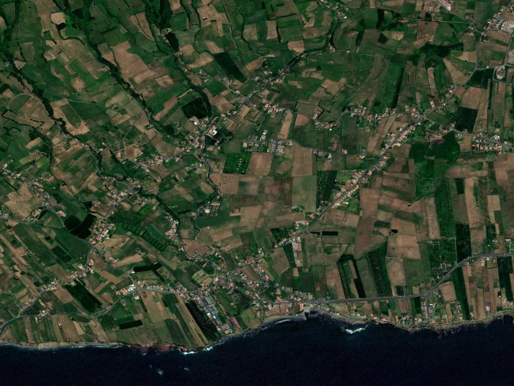
From crater to Atlantic
Feteira occupies a single 7.2-kilometre wrinkle between the sea and the island’s 1,043-metre summit. Below 150 m, smallholdings shelter under windbreaks of loose stone; Dwarf Cavendish bananas ripen in the lee. Higher up, Holstein-Friesians graze perennial ryegrass while, across the channel, Pico’s perfect triangle hovers 8.3 km away like a childhood lesson in geometry.
The 2009 miradouro dos Ilhéus das Cabras delivers the full stage: two basalt stacks—remnants of a submarine eruption 10,000 years ago—rising 80 m from a cobalt lane once used by American whalers. The PR05FAI coastal trail threads 5.2 km through hydrangea hedges introduced by 19th-century British expats, moss-covered walls of Homalothecium sericeum, and clearings where blackbirds drum tud-tud against the hush.
Staying the night
Wake to drizzle drumming banana fronds or to sun already glinting on Horta’s yachts. The Plantation—a 1952 English banana estate turned guesthouse—serves fruit cut at dawn with corn bread baked 2 km away in the wood-fired oven of Padaria do Visconde.
Feteira has absorbed its share of violence: the 1672 Cabeço do Fogo eruption smothered 900 hectares; the 9 July 1998 magnitude-5.8 tremor cracked 60 % of homes. Yet 1,776 people remain across 1,445 hectares, planting potatoes in March, harvesting maize in September, and distilling the air’s resinous heather into an unmistakable sense of place. There are no beaches, no crowds, no Instagram moments—only the slow cadence of an island that refuses to bend.