Full article about Ribeirinha’s black-stone hamlet above Atlantic vines
Ribeirinha, Lajes do Pico: 16th-century basalt parish, vineyard-walled trails, Espírito Santo soup feasts and loom-clacking museum
Hide article Read full article
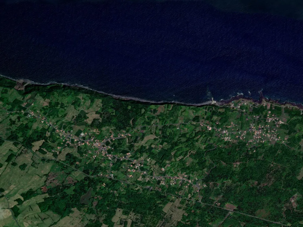
A thread of water, a slab of basalt
The ribeira that gives Ribeirinha its name is barely a trickle—thin enough to step over—braiding through black lava rubble before it slips between the walled vineyards (currais) and slips again into the Atlantic. Stand on Ponta da Ribeirinha, 98 m above the breakers, and when the cloud lifts São Jorge appears like a charcoal stripe on the horizon. Winter air tastes of salt and wood-smoke from the 343 chimneys that keep this parish alive.
Stone that remembers
Sixteenth-century chronicler Gaspar Frutuoso already listed the settlement in 1589, then an outlier of neighbouring Piedade. The parish church of Santo Antão, raised in the 1700s from the same dark basalt as every defensive house on Pico, has walls a metre thick. On 17 January its single bell still tolls down to Baixa harbour, a custom dating from 1863 when Ribeirinha became a curacy; full civil parish status arrived only in 1980.
Looms, broth and saints
Inside Casa das Tias Violantes an 1890s wooden loom clacks every weekday; visitors are simply asked to close the gate. Two streets away the Ethnographic Museum unlocks on Tuesday and Friday afternoons to show how yams and Verdelho vines sustained life before mains electricity.
During Espírito Santo feasts, volunteers ladle yam-and-fish soup straight from iron pots into enamel bowls, the only Azorean festival where the dish is still served in the street. On 29 June the population squeezes into the chapel of São Pedro for an 11 o’clock mass followed by a sardine grilling that perfumes the entire slope.
Between vines and sea
Walking trail PR18 PIC begins at Terra Alta viewpoint (415 m) and descends 4 km to Calhau beach—carry water, there is no kiosk. Parallel dykes of loose-stone wall climb the hillside like contour lines, trapping daytime heat for the vines and breaking the Atlantic wind. From Alto dos Cedros the whole north coast unscrolls, with São Jorge hovering on clear days.
At tiny Baixa harbour swimmers ease off the rocks into glass-clear water; the absence of sand keeps crowds away, but parking is exhausted by late morning in July and August.
Dusk stretches shadows across the basalt when Aunt Idalina finally stops her loom at six.