Full article about Prainha: Pico’s charcoal beach that whispered to the world
A lone black-sand bay, telegraph cottage and three defiant bridges anchor São Roque’s tiny outpost
Hide article Read full article
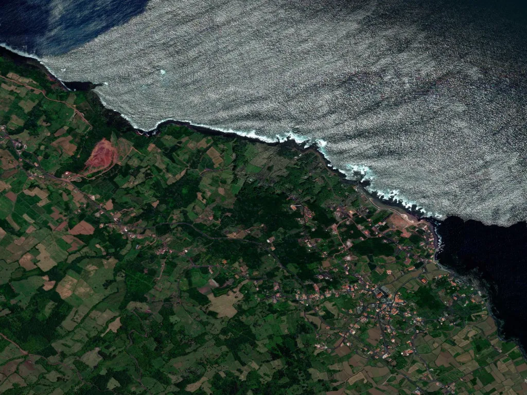
You hear it before you see it: a soft hush of miniature breaklets dissolving on dark, powder-fine sand – the only true beach on an island otherwise rimmed by jagged basalt. Baía da Areia is Pico’s geological oddity, a charcoal-coloured curl that faces the Faial Channel so squarely you feel you could skim a stone onto the neighbouring island. Around this anomaly the settlement of Prainha took root in the early 1700s; the name simply means “little beach”, a statement of fact in a landscape that never expected one.
The house that wired the Azores to the world
Beside the sand, a modest stone cottage painted custard-yellow once thrummed with the future. In 1893 the island’s first telegraph cable surfaced here, linking the Azores to Lisbon, London and, farther still, to New York. Morse code clattered through the volcanic walls of the “casa do fio” hours before news reached Horta or Ponta Delgada. The building, now a micro-museum run by the local residents’ association, still smells faintly of salt and copper; display cabinets hold porcelain insulators and a chart that logged President McKinley’s assassination a full day before the rest of Pico heard of it. While the island’s economy chased whales and wrestled Verdelho grapes from wind-lashed lava, Prainha was already talking to the world.
Bridges that outlast empires
The Ribeira de Nossa Senhora slices the parish from slope to sea. Spanning it are three stone bridges erected between 1780 and 1920. Ponte Velha, a single perfect arch of hand-cut blocks, once carried whale-oil casks to waiting boats; Ponte do Meio, widened with 1960s concrete, still rides its original 19th-century footings; Ponte Nova went up after the 1926 flood tore away its predecessor. Classified as island heritage in 2011, they are utilitarian monuments – each slab laid because no one fancied a thigh-deep ford in winter. Upstream, the parish church (1857-63) hides a gilded baroque altarpiece shipped from Lisbon in 1865; 50 m from the tide line, the chapel of St Peter waits for the annual maritime procession on 29 June, when fishing boats draped in paper carnations circle the cove. Between the two, the Calhau water-mill, built 1872 and silent since 1958, keeps its wooden wheel intact, now upholstered in moss.
The “mystery” that is simply lava
Above the hamlet spreads the Mistério da Prainha – not whodunnit but “mystery” in the Azorean sense: land smothered by 1562-64 eruptions. The 3.8 km circular trail, sign-posted by the regional environment service, crosses this young basalt into the island’s only coastal lava field within a UNESCO Global Geopark. Low heather, mountain-grape and the endemic festuca grass soften the rippled stone; the path dips to natural swimming pools drilled by the ocean, then out to Rocha do Galo, a blow-hole locals nickname “the devil’s eye”. At high tide the Atlantic sluices in, solar-heated to bath-warm; children cannon-ball from basalt ledges while adults float on their backs, watching Pico’s 2,351 m summit cut a shark-fin into the sky. Population density: 21 souls per km² – ample acreage for the cry of the Cory’s shearwater returning at dusk.
Wine between walls
Prainha sits inside the Pico Island Vineyard Landscape UNESCO site. On the surrounding flanks, 12 ha of vines grow inside 1.5 m-high currais – hollow rectangles of dry-stone wall that break the salt wind and radiate heat onto slow-ripening Verdelho. There is no château here; instead you knock at the door of Mr Manuel Rebelo, fifth-generation grower, who pours a mineral, Atlantic-tanged white in his kitchen while the Atlantic glints through the window. Twenty-three owners tend these hand-stacked walls, each inheriting a puzzle of black stone and green tendril that defies the ocean.
Late afternoon, when the sun flares low across the channel and Faial dissolves into violet silhouette, the dark sand of Baía da Areia glitters like wet mica. Nowhere else on Pico can you feel that particular silk under bare feet – proof that the sea once delivered what the island’s own volcanoes never could.