Full article about Pico’s salty lip: Santo Amaro’s tide-kissed vineyards
Walk the lava shelf where Atlantic spray salts Verdelho vines inside stone currais
Hide article Read full article
Salt on the Basalt
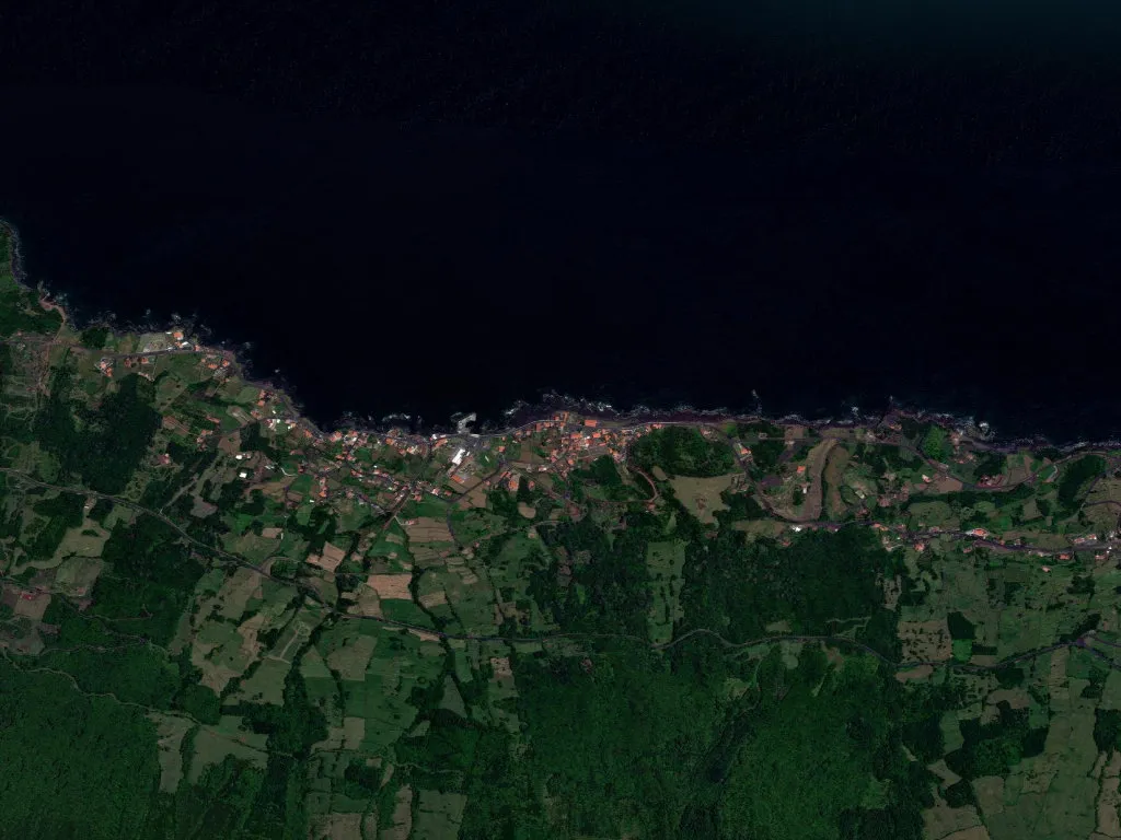
Crusted salt clings to the basalt before the next Atlantic pulse. In Santo Amaro the lava shelf offers no cliff-top drama; instead it stretches out like a submerged landing stage, letting the tide slither over its back until it laps the waist-high walls that corral Pico’s stubborn vines. At 4.6 m above mean sea level the margin between land and ocean is measured in fingers, not metres. Spray rides the prevailing nor’wester and settles on everything—iron gates, fig leaves, yesterday’s sheets that never quite dry on the line.
Stone grids and slow patience
This is the raw western edge of the UNESCO-listed Vineyard Landscape. Thousands of hand-piled rectangles—currais, 1 m wide, ½ m high—stamp a low basaltic chequerboard across the coastal platform. Inside each cell Verdelho or Arinto dos Açores crouches against the wind, the night-time warmth of the stones coaxing grapes to ripen where no trellis would survive. September’s harvest is still done on bruised knees: wicker baskets, secateurs, backs that ache long before the sun clears Faial.
Walk the foreshore and you tread lava that met the Atlantic 1,500 years ago when the Monte da Grota de Santo Amaro fissure disgorged its tongue. Gas bubbles frozen mid-escape give the rock the texture of coarse emery. The Azores Geopark classifies every outcrop: pillow lavas, hyaloclastites, fajãs—flat aprons of detritus wrested from the deep. At high spring tide the sea reclaims these stories, sluicing through the old harbour built by fishermen in 1947 and slapping against the 19th-century wine-stone walls.
A parish breathing out
Census 2021: 255 souls. Eighty-eight are over 65; only 26 under 15. Density—21.5 per km²—means scattered houses, large vegetable plots, long grass. Conversation happens on the church steps after the 10 a.m. Eucharist in the 1853 chapel, or on the quay when the supply boat São Roque eases in on Wednesday mornings. The primary school closed in 2009; Dona Lurdes’ grocery still opens nine-to-one; Zé’s café pours 30 ml of fig-firewater, never Pico wine—every litre of Verdelho is destined for the cooperative in Madalena and the export market beyond.
Light here is amphibious. Dawn fog erases the horizon; noon sun bleaches the whitewash to retina-searing brilliance; dusk wraps the lava in molten gold. The anemometer at São Roque has recorded breeze on 28 days of every month since 2001; even on “calm” days the halyards on moored dinghies chime against masts. The Atlantic is not scenery—it is a cohabitant. When a southerly swell rides the spring tide, brine vaults the currais and leaves tide-pools of saltwater on the lane. Gulls settle on the parapets, quarrel, lift on the updraft. Basalt steams dry in the sun until the next wave arrives and the cycle begins again—exactly as it did four centuries ago, exactly as it will tomorrow.