Full article about Cabo da Praia: Where Pico Island Floats Above Black Sand
Cabo da Praia on Terceira blends battle-scarred fort, cast-iron lighthouse and lava-walled tidal pools beneath sunrise-lit Pico views.
Hide article Read full article
Salt on the skin, black sand underfoot
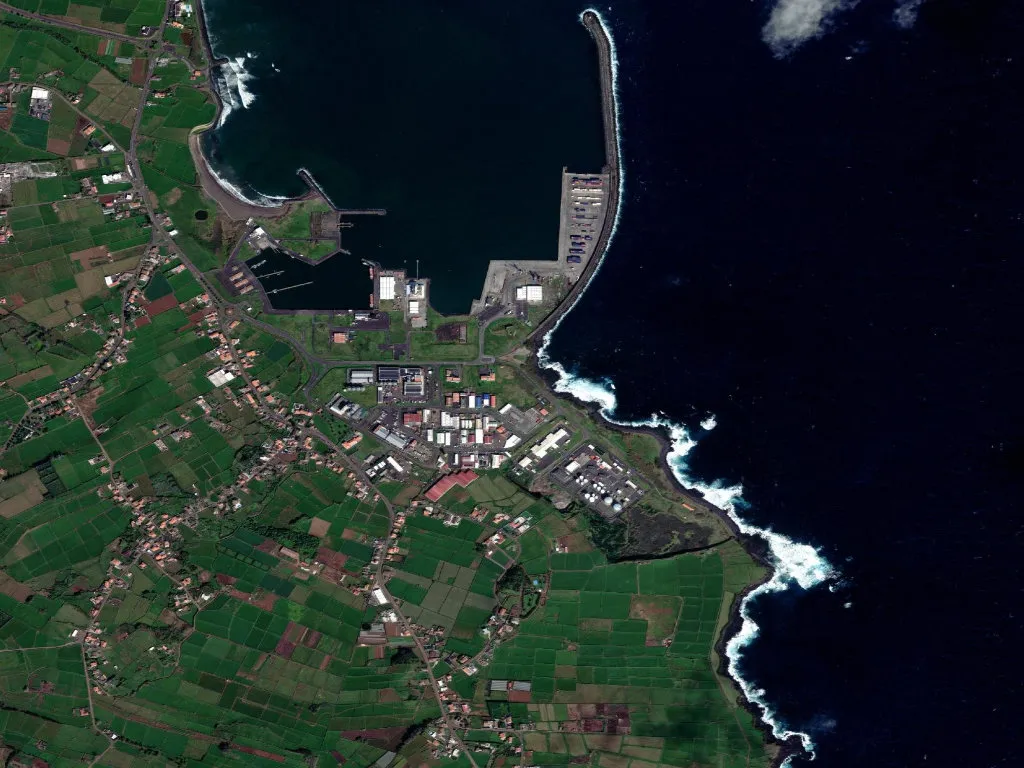
The Atlantic arrives without knocking. A wall of briny air slams into the slipway of Praia da Vitória’s sailing club, rattling the masts and flinging spray across the basalt like a metronome set to the lunar rhythm of the tides. This is Cabo da Praia, the eastern hinge of Terceira’s longest bay, where one-and-a-half kilometres of charcoal-coloured beach are backed by fossilised cliffs the Azores Geopark cites as textbook examples of sub-aerial volcanism. Dawn clocks in early here; sunrise clears an empty horizon and ignites copper glints on the stone façades, while forty kilometres away the perfect cone of Pico Island hovers like a paper cut-out.
When the cannons spoke
Fort Santa Catarina has watched this stretch of coast since the 1580s, but its guns found their voice in August 1829 during the Battle of Praia, the decisive naval clash of Portugal’s Liberal Wars. Liberal and Miguelist fleets exchanged broadsides across the dark sand; round-shot scars still pit the renovated ramparts that now house a small interpretative centre (free entry, Tue–Sat). Beside it, the seventeenth-century chapel of Nossa Senhora da Guia served as a seamark for outbound carracks; its iron window-grilles tremble whenever a northerly sweeps the promontory.
The 1926 cast-iron lighthouse a little further along is the only moveable beacon of its kind still working in the archipelago. Painted in red and white chessboard, it throws a white flash every ten seconds across the mouth of the bay. Below the lighthouse viewpoint, the tidal pools of Santa Catarina trap crystalline water inside rings of solidified lava—natural swimming tanks where you float an arm’s length from the open Atlantic yet remain shielded from its surge.
Clifftop path with gull soundtrack
The East-Coast Trail strings together five kilometres of cattle tracks and viewpoints between Cabo da Praia and the hamlet of Porto Martins. Allow two-and-a-half hours; the Atlantic is your constant right-hand companion, the cliffs a 60-metre parapet of pyroclastics. Between April and October Cory’s and Madeiran shearwaters colonise every fissure, turning the air into a raucous aviary. Out to sea, the Ilhéu das Cabras goat islet drifts in and out of Atlantic haze like a Chinese ink painting.
Halfway along you pass the roofless shell of Canada do Pescado’s tide mill—sluice gates, millrace and stone floor still intact. For two centuries the rising tide filled the reservoir; on the ebb it drove a pair of basalt millstones that ground local wheat and maize. Behind the trail, farmhouses follow the Azorean vernacular: cubic basalt walls, four-pitched roofs of small terracotta tiles, doors the colour of oxidised copper or jade to ward off evil spirits.
Volcanic sand between your toes
The beach itself is wide, dark and fickle—volcanic grains that scorch at midday yet stay fridge-cold until late morning. A smooth three-kilometre cycle lane shadows the promenade all the way into Praia da Vitória town centre. Inside the sheltering breakwater, stand-up paddlers glide across polished jade water; snorkellers drift over boulders crowded with salema and parrotfish.
Sunrise is the hour to be on the slipway. Light spills horizontally across the ocean, Pico blushes pink and tangerine, and the dawn wind delivers the smell of iodine and wet wrack. In that moment Cabo da Praia reveals its single, unchanging truth: the sea is not scenery here—it is atmosphere, metronome and landlord, shaping every stone, every wall, every gesture of the 670 souls who live on its edge.