Full article about A dos Francos
Walk silent levadas between PDO Pêra Rocha rows outside Caldas da Rainha
Hide article Read full article
Pear Country
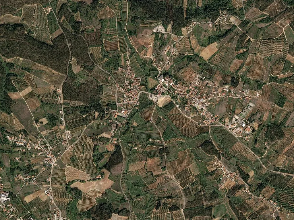
The perfume of ripe fruit hangs low over A dos Francos, where orchards are laid out like green chessboards all the way to the horizon. Only the occasional white farmhouse or streak of eucalyptus breaks the grid. Five kilometres south-east of Caldas da Rainha’s thermal spa, the parish still follows a medieval blueprint: long, rectangular plots separated by waist-high walls of pale limestone and fed by narrow irrigation channels that glint when the sun strikes them.
The name – “Village of the Franks” – records the 12th-century settlers who were granted land here in return for military service. They brought with them pruning knives, grafting skills and a taste for order that turned 1,944 hectares of heavy clay into one of Portugal’s most reliable fruit baskets. The same soil and Atlantic climate now ripen Pêra Rocha do Oeste, the only pear in Europe with PDO status west of the Tagus. From mid-August the lanes clog with flat-bed lorries and the packing warehouses vibrate with grading machines that sound like amplified playing cards.
Roots and branches
There is only one listed building – a modest 16th-century chapel classified in 1982 – yet the whole landscape is an open-air archive. Follow the levadas (water channels) and you can read where 13th-century hands diverted the run-off; trace a boundary wall and you’ll find fossilised oyster shells pressed into the mortar by farmers who worked the land between tides. Population density is below 84 people per km², so silence pools easily. Ten small guesthouses, most of them converted stone barns, let you wake to cockerels and the soft diesel cough of the first tractor heading for the rows.
Plate and glass
Breakfast is sliced PDO pear on crusty pão de milho, the flesh grainy, sweet and cool from the orchard fridge. Lunch might be a salad of Alcobaça IGP apples – sharp enough to make your jaw tingle – followed by pork from animals fattened on windfall fruit. Finish with a thimble-full of ginja, the Morello-cherry liqueur that arrives in a dark-chocolate cup you are expected to eat. Everything on the table, including the cabbage and tomatoes, has travelled less than a kilometre.
The parish sits on the coastal branch of the Camino de Santiago; walkers enter on a dirt track between pear rows, exit through a pine plantation, and barely meet another soul. The route is part of the UNESCO-branded Geopark Oeste, though at 52 m above sea level the drama is human rather than geological: the sudden blaze of orchard blossom in March, the mechanical ballet of harvest ladders in September.
At dusk the fruit pickers pack up. Golden light skims the treetops and long shadows stitch the earth. Somewhere a dog barks once. Bite into a pear straight from the branch and the juice runs over your wrist – a small, sticky contract between land and hand that has been renewed here for nine centuries.