Full article about Trancão Flats: Three Villages Beneath the A1
Baroque chapels, hidden fountains and tidal reeds in Loures’ most densely fused freguesia
Hide article Read full article
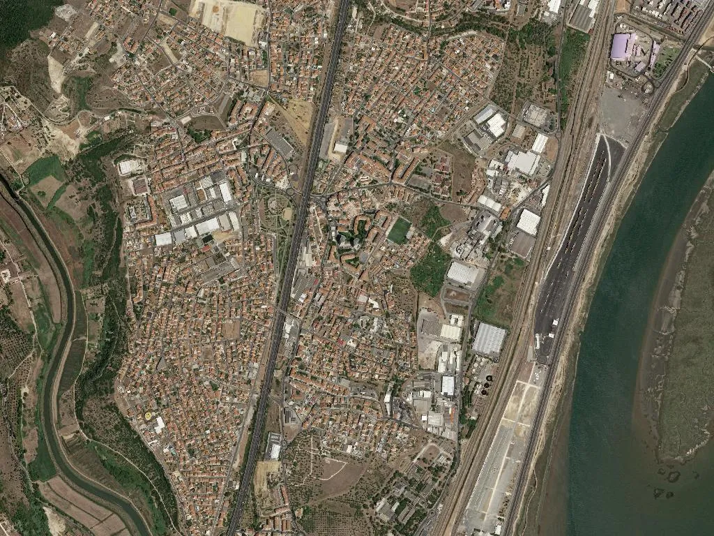
Where the Trancão Meets the Tarmac
The Tagus exhales across the flats at 08:30 on a Tuesday, carrying silt, salt and the diesel tang of the A1. Low sun drags shadows across the service roads of São João da Talha, striking the glass of logistics warehouses and slipping down the last whitewashed walls that hold out between fresh-plastered apartment blocks. Forty-four thousand people in seventeen square kilometres: no picture-postcard Portugal here, just strata laid one over another—market gardens beneath asphalt, a chapel beneath a roundabout, a stream forced underground into a concrete sleeve.
The civil parish union was rubber-stamped in 2013, but the stitching together of Santa Iria de Azoia, São João da Talha and Bobadela began long before. Quintas were swapped for housing estates; density now tops 2,500 souls per square kilometre. Step off the spinal road and you’ll find alleys where Monday’s sheets still flap like neighbourhood flags.
Baroque stone among the breeze blocks
Santa Iria’s mother church arrives without warning, wedged between a stationery shop and a café that sells 40-cent espresso. Soot-darkened baroque stone, one of only three listed buildings in the entire parish. Inside: gilded carved wood, 18th-century azulejos, sudden silence. The name first appears in a 1250 charter; Azoia itself whispers of al-Andalus, a toponym that survived the Reconquista and three motorway extensions.
Bobadela and São João favour discretion—worn stone fountains, manor houses masked by cement walls, their identity betrayed only by the rhythm of sash windows and granite corners.
Tracks between concrete and river
The Ecoparque de São João da Talha squeezes a grid of dirt paths and cycle lanes between distribution hangars. Diesel fumes thin; damp earth and eucalyptus take over. After rain the ground smells of iron. The Trancão River, tidal here, slides brown and slow past reeds and the occasional egret. Pick up the Lisbon branch of the Caminho de Santiago and you’ll share the embankment with walkers heading north, discreet as commuters rather than pilgrims. What is now a warehouse hinterland was once the obliged crossing to the capital.
Stews, fish stew and a nun’s sweet
Restaurants do what they have always done: cozido à portuguesa piled high, lamb ensopado scented with mint, caldeirada stained red with paprika. A sharp Bucelas white cuts through the fish stews, followed by queijo curado and a slice of marmelada branca de Odivelas—quince paste invented in a 16th-century convent a few kilometres south.
44,000 lives ten minutes from the Expos
A1, A8, A30, IC2—arteries that feed Parque das Nações and the airport. Many residents clock in across the river; ten thousand are over sixty-five, six thousand under fourteen. Park benches fill by late morning. In the Maroitas quarter narrow lanes force neighbours into daily negotiation; there are no boutique guesthouses, just 24 functional rooms above cafés and pharmacies. Average elevation: 48 m of gentle swell. Late light flattens everything into grey concrete and milky estuary haze.
When the A1 clots, the wind shifts above the Trancão, bringing marsh gas and pine resin. Neither city nor countryside: an egret lifts, drifts east, vanishes towards the Tagus.