Full article about São Vicente e Ventosa: olives, Roman road & silence
Walk Roman stone roads between limestone churches and Guernsey-sized Caia lake in Portugal’s empties
Hide article Read full article
Stone, water and Roman memory
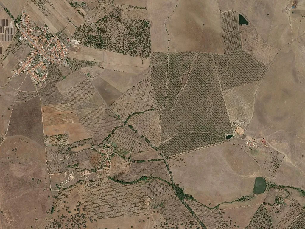
The wind combs the olive terraces at walking pace, dragging the scent of baked earth and holm-oak resin across 104 square kilometres of border-country plateau. With only seven people per square kilometre, the parish of São Vicente e Ventosa is Portugal’s second-largest by area and first in elbow-room. Sound is reduced to footfall, cicada rhythm and the soft knock of olive wood when pruners work the canopy. Time is calibrated by almond blossom in February and the slow November swell of olives that will become DOP-branded oil.
Stone arrives first. The parish church at São Vicente has presided over its handful of streets since 1598, paid for by Dom António Mendes de Carvalho, Elvas’s first bishop. Pale limestone absorbs the late-afternoon heat; inside, the air is stone-cool, a refuge from the 40-degree glare. Five kilometres east, the white bell-tower of Nossa Senhora da Ventosa rises from an estate of the same name, a solitary exclamation mark amid the cork-and-holly montado. The building is younger (1727) but feels monastic, approached only by a dirt track that pistons dust into the vines.
Romans were here first. Their villae, grain stores and wine presses lie just beneath the topsoil; Quinta das Longas keeps a barn piled with column drums and millstones. The Caia valley was a breadbasket then as now, feeding the garrison town of Évora and, further west, the provincial capital at Mérida. A surviving stretch of the Elvas–Badajoz Roman road—two metres wide, stone-cambered, still cambered for drainage—cuts straight across modern olive groves; you can walk it in ten-minute silence, tyre ruts fossilised into ruts made by iron-shod carts.
A reservoir the size of Guernsey
In 1954 engineers plugged the Caia river and created the largest reservoir in the Alto Alentejo: 19 square kilometres of sky-reflecting water shared with Spain. Above the dam wall, purple herons and glossy ibis stalk the reed beds; below it, twenty smaller ponds glint like polished silver among the olives. None are sign-posted, none charge entry. On a weekday in May you may share a bank only with a shepherd rolling cheese and chorizo on to crusty bread while his merino flock drinks.
Cyclists use the farm tracks that loop from São Vicente to Alentisca, pausing beside mirror-bright ponds to eat apricots warm from the saddle-bag. There are no way-marked trails, no visitor centres—just space, and the low mechanical click of an irrigation arm turning through wheat.
Garlic bread soup and Sunday’s metal quoits
Alentejan grammar rules the kitchen: açorda thickened with poached egg and coriander; migas of bread and lamb dripping; purslane soup that tastes of iron and melon. In Elvas, ten kilometres away, sericaia arrives trembling, cinnamon-dusted, the perfect close to a meal that began with Queijo Mestiço de Tolosa IGP and a glass of roble-tinted red.
Sunday afternoons belong to the parish malha pitch, a 20-metre lane of packed earth under holm oaks. Players hurl fist-sized iron discs at a single metal pin; the clink of strikes carries farther than conversation. The Elvas municipal tournament pauses here each July, drawing three generations who referee themselves, keep score with chalk on a slate, and break for iced coffee when the shade shifts.
The weight of absence
The 2021 census counted 732 inhabitants, 202 of them over 65, 79 under 14. The Socialist vote still tops 70 per cent, yet the populist Chega party doubled its share to 18, a tremor of generational fracture. Inherited land anchors some; WhatsApp group chats lure others to Lisbon or Bordeaux. Those who stay understand the currency of silence, the luxury of a horizon uncluttered by cranes. At dusk they taste last year’s olive oil poured over warm cornbread, and measure another season by the slow filling of the reservoir and the first almond petals blown across the terrace.