Full article about União das freguesias de Arez e Amieira do Tejo
Walk 485-million-year seabed, Templar keep, 450k olive trees—392 souls share the sky.
Hide article Read full article
A Silence You Can Walk Through
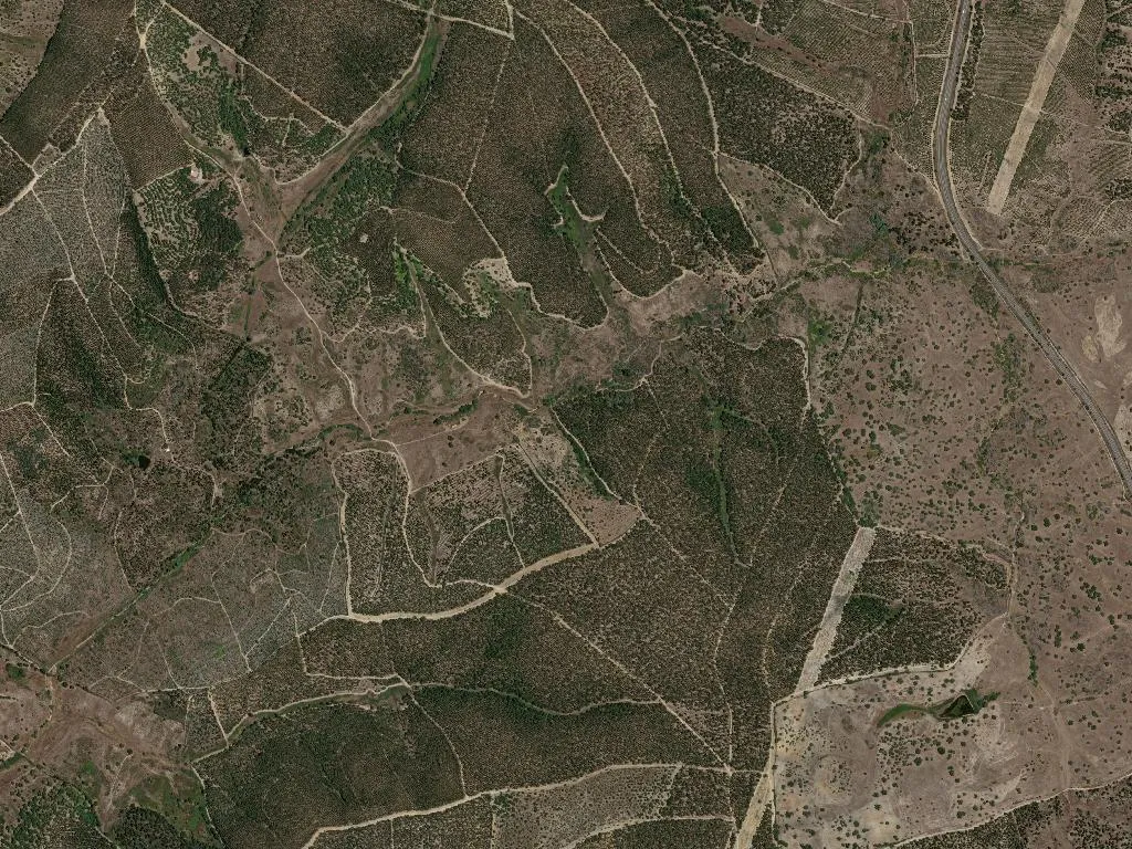
The sky is larger here. From the ridge above Arez, it vaults over 450,000 olive trees and an equal number of cork oaks, each planted far enough apart that their canopies never touch. At noon the shadows shrink to charcoal coins at the foot of every trunk; at dusk they stretch into long charcoal spills that touch the Tagus, 45 m below. The parish counts 392 souls—2.5 per square kilometre—so the horizon feels upholstered in breathing room.
The Templar Keep That Never Surrendered
Twelve kilometres of tarmac coil downhill to Amieira do Tejo, where Dom Gualdim Pais, Grand Master of the Temple, raised a keep in 1232 to tax river traffic. The limestone blocks are the colour of dry wheat; the spiral stair is 1.20 m wide, just enough for a man in mail to swing a sword. Only 2,300 visitors a year climb the parapet, so your footfall still echoes like a threat. From the battlements the Tagus slides east, slow and pewter, exactly 45 m beneath you—the altitude written into the stone.
Five Millennia Before the Knights
2.5 km outside Arez, a granite dolman known as Anta de São Gens pokes from a pasture like a broken tooth. Dated 4000–3000 BC, the chamber is older than Stonehenge and has never been roofed; night skies have rained starlight on the bones for sixty centuries. A single 1997 brass plate, the size of a postcard, gives the facts. Cowbells clonk somewhere beyond the gorse; otherwise the wind does the talking.
Ordovician Footprints
Since 2006 the entire parish has sat inside Naturtejo Geopark, a UNESCO reserve that treats schist like scripture. Walk the PR1NIS trail (13.5 km, Arez–Amieira) and you tread on ocean-floor ripples 485 million years old. The riverine path PR2NIS ends at a beach where white poplars—amieiros—give the village its medieval name, Alamaria. Kingfishers stitch fluorescent threads above the water; otters leave five-toed signatures in the mud.
What the Land Tastes Like
Breakfast begins with Queijo de Nisa DOP, a thistle-rennet cheese aged thirty days until it can be bent without breaking. Lunch might be a slice of Queijo Mestiço de Tolosa IGP, its rind pressed with paprika and olive oil. Between meals you mop North Alentejo DOP olive oil—0.2 % acidity, green-apple nose—from 450,000 trees that survive on 300 mm of rain a year. In winter, black pigs graze the montados; their hams hang for three months in chimneys perfumed with rosemary smoke. The local loaf weighs 1.5 kg, crust cracked like a lakebed, crumb the colour of parchment.
Stone, Water and a Little Heat
The parish inventory is short but decisive. Arez’s mother church rose again after the 1755 earthquake; its altar is painted the shade of dried blood. Amieira’s sixteenth-century chapel of Nossa Senhora dos Prazeres has a single nave and a door just 1.6 m high—humility carved in dimensions. Seven kilometres away, sulphurous water at 38 °C bubbles from the Fadagosa spring, noted in medical journals since 1902; soak at sunset and you smell faintly of struck matches for hours.
By 21:30 the castle stone has cooled from 45 °C to skin temperature and the night air smells of hot rosemary. A grey heron lifts from the Tagus, wings creaking like wet rope. Then nothing—just the sky, the river and 392 people breathing slowly under it.