Full article about Lamelas & Guimarei: Where Time is Tolled, Not Told
Medieval mule-roads, 1952 bell law and Romanesque stone still shape Santo Tirso’s twin villages
Hide article Read full article
The bell in the tower of Lamelas strikes at seven sharp – morning and evening, winter and summer. The decree was issued in 1952 by parish priest António Ferreira; seventy-two years later João Carvalho, 78 and still spry, climbs the same stone stairs to swing the iron tongue that measures out the day. Its bronze note slips down the Leça valley, crosses the ER 240, drifts over the ridge at Portela and settles on the terraced fields of Veiga like an audible tide-mark. No one here needs a watch; they simply listen.
Two Villages, One Parish
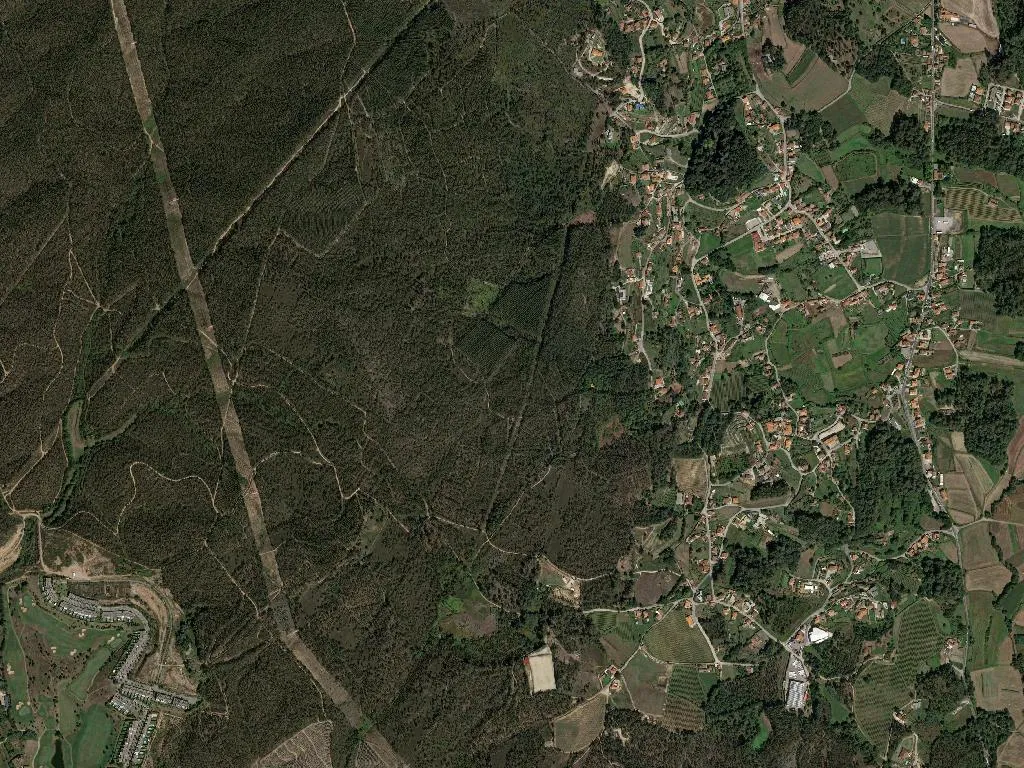
Administrative maps were redrawn in 2013, yoking Lamelas and Guimarei into a single civil parish, yet each settlement keeps its own medieval pulse. Lamelas appears first, named in 1044 in the Rol das Igrejas do Rei, a royal inventory of ecclesiastical rents; Guimarei follows a year later, recorded as “villa Guimaredi in ripa Ave”. Both belonged to the vanished municipality of Refojos de Riba do Ave until 1836, when they were absorbed by Santo Tirso. The Brandões, a minor gentry family, stamped their identity on Guimarei: their 1593 stone cross still stands in the churchyard, coats-of-arms crisp under the lichen. Lamelas, meanwhile, lived off movement. The Estrada Real – the paved highway that linked Porto to Guimarães – threaded through the village, and the now-ruined Casa do Almocreve once gave bed-space to thirty muleteers and fifty animals. A 1.2 km stretch of that same granite setts survives on the Vale Longo lane, potholes polished by centuries of iron-shod hooves.
What the Centuries Forgot to Erase
The parish church, dedicated to Santa Eulália, has presided over the ridge since 1123. Its façade is an elegant late-18th-century re-face, but inside the Romanesque core lingers: a round-arched granite portal, 1.85 m high, quarried from local stone and replaced exactly where it was built eight hundred years ago. A hundred metres away the chapel of Santo António has not been so lucky. After the storm of 1947 ripped off its barrel vault the little building was left open to the sky; the cracked font lies toppled among nettles, and the niche that once held the saint’s image gapes like a missing tooth.
Water sources are older still. The Portela fountain, dated 1892 on its architrave, was ordered by the long-defunct Refojos town council; the Fonte do Lobo, carved 1847, slaked the thirst of mule trains, then grape-pickers, and now irrigates the allotment terraces of Vale Longo. On the Devesas knoll a eucalyptus planted in 1904 has become a landmark in its own right – 35 m tall, 3.2 m in girth, witness to the road’s tar-spraying in 1958 and to the inauguration of the Central Portuguese Way of St James in 2015.
Way-marked Time
For 4.3 km the Caminho Português Central cuts straight through the parish: it enters at Portela, passes the church, drops to the Leça and leaves beside the wayside cross of São Bento. Most walkers cover the sector in 70 minutes, between O Pascoal’s café (open at seven) and Zé da Calçada’s bar in Guimarei. Last year 2,841 of them paused to sign the visitors’ book in Lamelas – an average of eight a day, their scallop shells clacking like castanets against rucksack frames.
The festival calendar has been identical since 1950:
- 15 August – Nossa Senhora da Assunção, Lamelas: 11 o’clock mass, communal lunch in the sports hall, folk-dance display at three.
- 24 June – São João do Carvalhinho, Guimarei: torch-lit procession, midnight rockets, village dance until four.
- 11 July – Romaria de São Bento: 7 a.m. departure from Lamelas, climb to the 1717 hill-top hermitage, open-air mass, sponge-cake and chilled vinho verde served on the grass.
- 13 June – Santo António, Lamelas: street supper of caldo verde, paper-lantern contest, children’s parade.
Rehearsals for the Santa Eulália folk group take place every Tuesday and Friday at nine in the parish-council hall. The troupe – 34 dancers aged between 9 and 74 – revived the Vira de Lamelas in 2010 after a 47-year hiatus, using field notation collected by the local schoolmaster José Maria Pereira (1912-1998).
Vine Roots
The entire parish lies within the Sousa sub-region of Vinho Verde. Forty-two growers tend 28 ha of trained vines and a further 11 ha of pergola-trained plots; Loureiro accounts for two-thirds of plantings. Average yield is 70 tonnes, all delivered to the cooperative at São Miguel da Serra. Picking starts around 15 September; in 2023 120 seasonal workers cleared the terraces during three consecutive weekends, their secateurs clicking in time with the bell across the valley.
The parish coat-of-arms, approved in 2015 and designed by Guimarei-born heraldist Nuno Gonçalves, quarters a silver field strewn with red grapes, the Brandão packhorse emblem, and a border of seven towers recalling Lamelas’s 1514 royal charter.
Ledger of the Living
Population: 1,567 (2021 census).
Children under 15: 176.
Pensioners: 361.
The primary school in Lamelas has three classes and 31 pupils; Guimarei’s closed its doors in 2019. Commerce is concentrated in four establishments: Café O Pascoal, Mercearia da Bia, Padaria do Zé, and Farmácia Popular (weekdays 9-1, 2-7). On Sunday afternoons the football ground’s changing rooms echo with the voices of eight district-league teams; the pitch looks across the valley toward the granite ridge where, at dusk, the bell sounds for the second time.
The note rolls downhill, reaches the river, and finally dissolves among the eucalyptus leaves. Somewhere on the Santiago path a tired pilgrim rolls tighter into a sleeping-bag; in the village a shopkeeper pauses, hand on shutter, until the bronze hum fades. Tomorrow João Carvalho will climb the tower again, and the day will begin exactly as it did yesterday, and as it will long after the last Loureiro vine has been grafted and the final Vira danced.