Full article about Ortiga: Where Olive Oil Echoes in Empty Lanes
Sun-lit cobbles, river-murmur and a mill grinding DOP oil after dark—Ortiga waits.
Hide article Read full article
First light
At 07:50 the sun slants into the single main street of Ortiga, stretching shadows across whitewash the colour of whey. The only sounds are the church bell—eight, noon, seven—and the shuffle of flip-flops on cobbles climbing towards the primary school that closed its doors in 2017. Beyond the last house the Ocreza river slips southwards; the parish spreads across 16 km² of undulating olive and cork, inhabited by 534 people, 261 of them over sixty-five. Only twenty-four are under fifteen. The mathematics is blunt: each census subtracts voices.
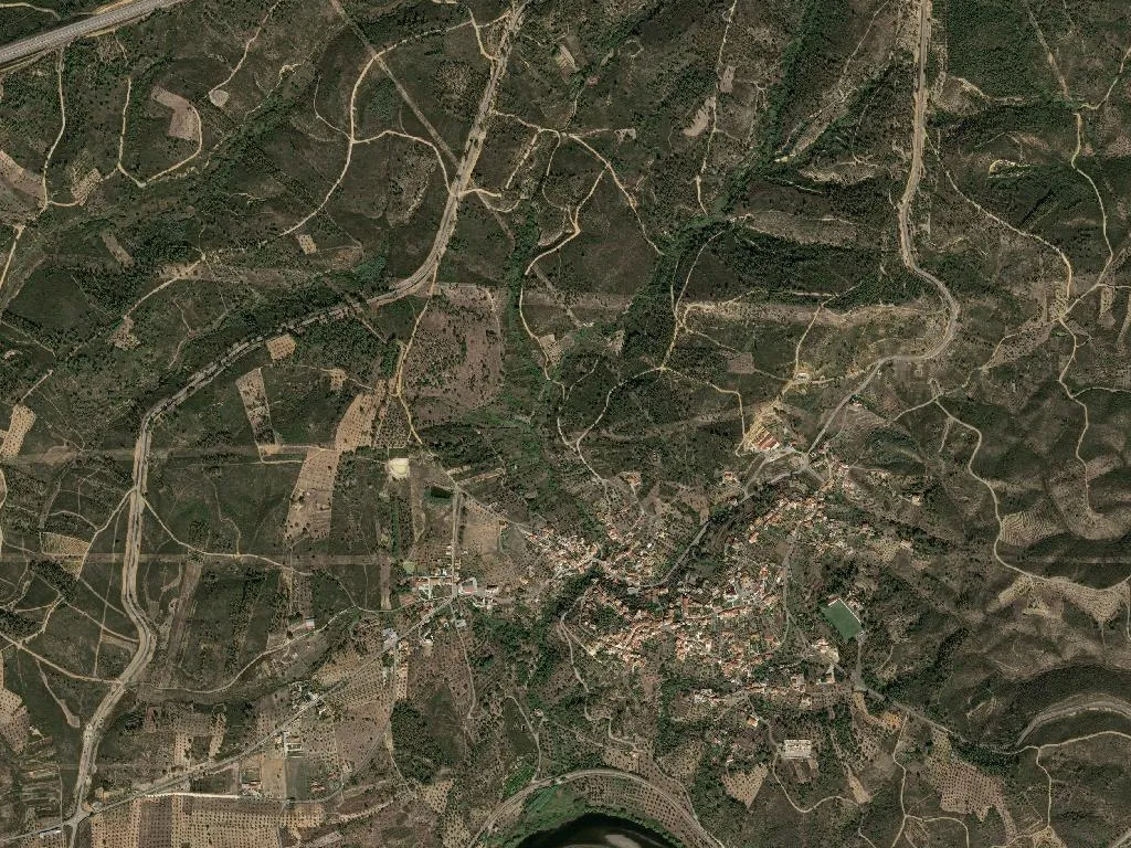
Territory without crowd
The land sits at 117 m above sea level—too low to be hill country, too broken to be plain. Olive groves roll in every direction, their silver undersides flicking like fish when the wind changes. There is no tourist office, no gift shop, no interpretative board. Cyclists from Cologne appear on the Belver–Mação rail trail, refill bottles at the fountain, and pedal on. Accommodation is limited to three family houses registered with the council: knock, hand over cash, receive a key. Space is the commodity here; silence its dividend.
What the ground gives back
Three protected designations overlap in these groves—Beira Alta DOP, Beira Baixa DOP and Ribatejo DOP—so every litre of oil carries a passport. The cooperative mill, opened in 1953, still threshes fruit from five neighbouring parishes between October and December, the granite stones rumbling until 22:00 when the air turns sharp with crushed olives. The same pastures qualify for IGP kid (Cabrito da Beira) and DOP beef (Carnalentejana), animals raised on montado—the open cork-oak system imported from Alentejo. There is no tasting menu. Lunch is whatever the baker slid into the wood oven at dawn: kid whose skin fractures like sugar, beef sliced from the grill, bread spongy with local oil. You eat at a Formica table, napkin roll weighted with the vinegar bottle. Gastronomy is not performance; it is Tuesday.
Stone and subtraction
Two state-listed buildings interrupt the scrub: the Manueline-Gothic chapel of São Brás, its portal carved in 1515 and tweaked in 1755, and the 1595 town hall-cum-prison that served until the Liberal reforms of 1834. Ortiga lost municipal status in 1836; the building became a hay store. Parish archives begin in 1723 but are laconic—birth, marriage, death, repeat. Walk 400 m downstream and you meet the Roman balneário of Vale de Junco, its hypocaust tiles still in situ, half-submerged by the Ocreza. No rope, no ticket desk, no selfie-frame.
Slow margin
The river beach at Praia Fluvial de Ortiga is a platform of fine sand dredged from the Belver reservoir, supervised in summer by a single lifeguard who doubles as bartender. Behind it, the PR4-Maçã footpath loops 12 km through cork and arbutus, past the Anta da Foz do Rio Frio, a Neolithic dolmen used latterly as a sheep pen. Signage is intermittent; the reward is perspective over the Tejo’s molten copper at dusk. Contemporary travel wants deliverables—five stars, foam art, redemption in 24 hours. Ortiga offers none. What remains is the odour of woodsmoke at 18:00, the metallic tang of new oil on fingers, the hush of a place that continues to be worked even as the workforce evaporates. Stay longer than an hour and those layers fix themselves to your clothes; they will not come out in a city wash.