Full article about Dawn orchards & salt-breeze over Outeiro da Cortiçada
Walk between IGP apple rows, centuries-old olive groves and limestone outcrops in Rio Maior’s quiet orchard parish of Outeiro da Cortiçada e Arruda dos Pis
Hide article Read full article
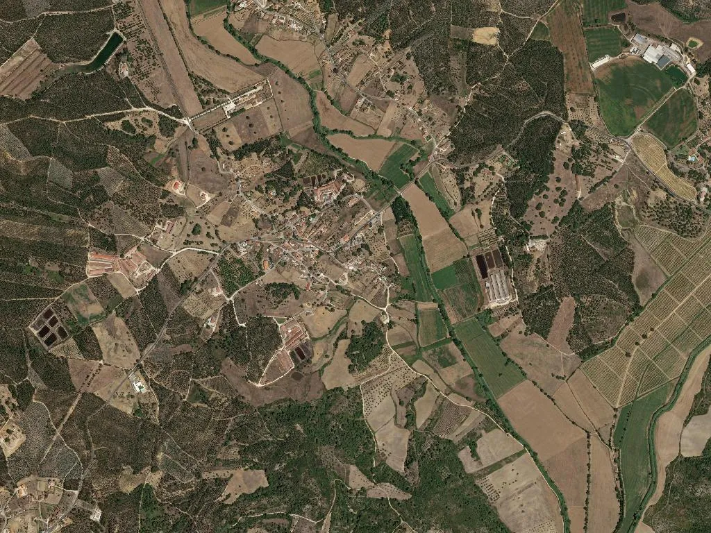
At first light the soil exhales; dew settles along the rows of Pêra Rocha pear and Royal Gala apple that quilt the low hills of Outeiro da Cortiçada and Arruda dos Pisões. Streams glint between centuries-old olive groves, their trunks corrugated like antique armour, and the air carries a faint memory of salt—Rio Maior’s famous rock-salt pans lie only twelve kilometres away. The land was once marsh; the water table is still high enough to feed orchards without irrigation, and the limestone bedrock—an eastern outlier of the Serras de Aire e Candeeiros—breaks the surface in pale, sculptural slabs.
A merger of two hamlets
Administratively the parish was born in 2013, but the marriage is older. Arruda dos Pisões appears in Portugal’s first national census of 1527 with 27 hearths; its name hints at both the wild rue that scents the lanes and the stone pestles (pisões) once used to full cloth and grind grain. Outeiro da Cortiçada, the “Cork-Covered Hilltop”, still carries a scatter of cork oaks whose thick bark is harvested on nine-year cycles. Together they cover 24 km² and shelter 957 residents—fewer people than fit inside a single London Underground carriage at rush hour.
What the land gives
Agriculture here is not scenery; it is bookkeeping. Orchard plots are measured to the last fig, and every tractor comes with a folder of DOP and IGP certificates. The apples qualify for Maçã de Alcobaça IGP status; the pears are bona-fide Pêra Rocha do Oeste DOP; the olive oil is cold-pressed in working mills whose granite millstones date from the Salazar era. A catastrophic olive-fly outbreak in 1939 wiped out an entire harvest, so today growers hang sexual-trap lures in the canopy like discreet Christmas ornaments. Vineyards supply the Tejo DOC, but locals still ferment a little table wine in plastic barrels for household use.
Paths of water and stone
The parish boundary brushes the edge of the Serras de Aire e Candeeiros Natural Park; way-marked trails leave from picnic parks at Outeiro, Arruda and the hamlet of Correias. One of them is the Portuguese Caminho de Santiago, the Torres variant, which slips through vegetable plots and disappears into holm-oak maquis where the only sound is the pneumatic drill of a woodpecker. There are no ticketed monuments, yet the geology is an open museum: karst pavements, fossil-rich boulders, and a swallow-hole that locals swear still rings hollow when you stamp on it.
The arithmetic of staying
With 39 inhabitants per km², silence is measured in hectares. The parish council runs a library and a day-centre where 300 pensioners outnumber 107 under-25s, but the real social hub is the early-morning auction at the Rio Maior fruit cooperative. Saturday evenings belong to the multisport pavilion: five-a-side football under strip lighting, the bar pouring Super Bock into plastic cups. On feast days the village band strikes up a waltz, brass slightly off-key, and the smell of grilled chouriço drifts across the playground.
Evening light slants through the orchards, turning pear skins translucent and warming the limestone to honey. A stork tilts overhead, legs trailing like landing gear. In Outeiro da Cortiçada and Arruda dos Pisões the souvenir is not a fridge magnet; it is the weight of a just-picked pear in your palm, the peppery catch of new olive oil at the back of your throat, the certainty that somewhere a tractor is still turning earth that has been worked since before the Reconquista.