Full article about Granite, River & Chouriço Smoke Above Galafura-Covelinhas
Stand on São Leonardo’s 640 m chapel terrace, scent thyme, taste farmer’s wine, watch Douro’s silver
Hide article Read full article
Warm granite, silver river
The retaining wall heats like a bread oven under the late-afternoon sun. Six hundred metres beneath my elbows the Douro slips past, a polished blade between schist terraces that descend in ruler-straight ledges to the water. Up here on Monte de São Leonardo—640 m above the Atlantic, high enough for red-rumped swallows to circle at eye level—the air smells of warm thyme and last year’s vine prunings. A single bell note floats over from the chapel, the only clock the parish still trusts.
Names carved in stone
Galafura and Covelinhas were stitched together by administrative fiat in 2013, yet their separate histories read like overlapping parchment charters. Covelinhas received its royal market licence from King Sancho I in January 1195, giving the settlement the right to charge tolls on boats hauling oak barrels up-river. Galafura, recorded as part of the Terras de Panoias in 1341, kept its vineyards under the jurisdiction of Vila Real. The toponyms themselves are fossils: Galafura from the Latin Galafrum, “people of the river”; Covelinhas from the pre-Roman “cova”, the deep-cut valley that still funnels the road downhill. Traces of Roman gold-workings survive on São Leonardo and at the nearby Castro de São Xisto—slag heaps glinting with mica among the gorse.
A chapel that owns the horizon
The whitewashed Capela de São Leonardo stands precisely on the watershed. From its forecourt you can watch weather systems collide: Atlantic rain sliding in from the west, Iberian heat rising from the east. Miguel Torga, the physician-poet who walked these hills between patients, called the view “a geological poem”, a phrase now carved on a slate plaque beside the altar. On the penultimate weekend of August the chapel’s annual romaria turns the summit into an open-air refectory: smoke from chouriço grills, the metallic rasp of the gaita transmontana, and wine drawn straight from the farmer’s own demijohn.
Seven classified buildings pepper the parish—one municipal, six public interest—bridges, threshing-floors and a granite press-house dated 1783. They share the same palette: schist for the terrace walls, granite for corners and doorways, oak for the lagares still trodden every September. The interior variant of the Portuguese Camino—Via Lusitana—crosses the ridge here, way-marked by yellow arrows painted on millstones.
What lunch tastes like at 640 m
Roast kid arrives burnished with paprika and garlic, the ribs lacquered to a deep bronze. It is served with batatas murras—small potatoes cracked open in the pan—and a glass of 2021 tinta roriz from Quinta da Gaivosa that smells of wild blueberry and hot slate. After the meat comes corn broa, its crust audible under the knife, thickly spread with toucinho fat and a slice of presunto cured for thirty months in the mountain air. Dessert is a warm sponge pão-de-ló wrapped in a linen cloth, the centre still trembling, plus a thimble of moscatel that tastes of orange blossom and altitude.
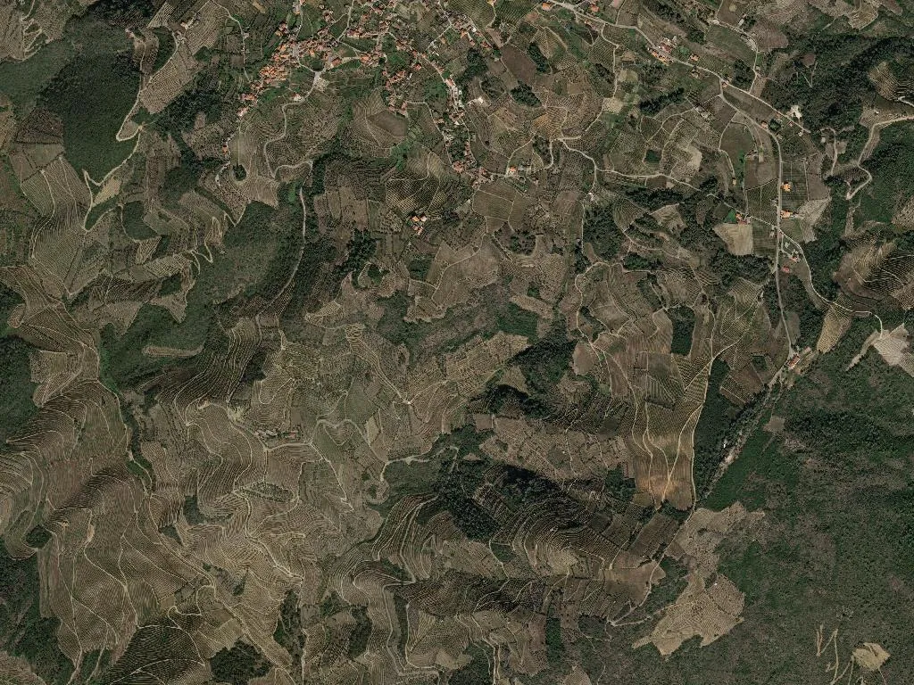
Terraces that breathe
UNESCO listed the 2,000-year-old terrace system in 2001, but the farmers had already read the memo. Between 200 m and the summit the slopes are staircased into 1,585 ha of living geology: schist retaining walls, granite spillways, narrow earth benches no wider than a dining table. In April the vines show the pale green of fresh olives; by late October the leaves flare vermilion against the grey ribs of rock. Wild boar root along the walls at dusk; Bonelli’s eagles ride the thermals above. Walking tracks thread the gradient—old caminhos de serviço once used by ox-carts hauling grapes to the river quays.
Calendar of the 705
The parish counts 705 inhabitants, 1585 hectares and two days when silence is outlawed. On 15 August the Festa de Nossa Senhora do Socorro in Covelinhas fills the river beach with processions and river-barge races. A week later the São Leonardo pilgrimage ends with a candle-lit descent to Galafura, the track flickering like a lava flow. The rest of the year is quieter: pruning knives click in January, the first bud-break comes with the nightingales in March, and September smells of crushed grapes and diesel as the vindimas begin. Somewhere in between, the granite keeps the sun long after the valley is in shadow, and the river below keeps its own slow time, polishing the schist one grain at a time.